The Colorado Trail and back 940 miles!

This adventure happened seven years ago between July-Aug 2003
Thirty four years ago I met the MAN–the father of the Colorado Trail, Mr. Bill Lucas. His daughter was going to school at Colorado State University and I gave her a ride home and got to met him. Mr. Lucas was a big fan of the European trail system and wanted to start one in Colorado. Bill and I aren’t exactly drinking buddies, but casually knowing the founder put the CT into a special place in my heart. When the maps of the trail were first published many moons ago, I went out and bought them. I have opened and closed the maps so many times the creases became gaps, where my dreams were held tight. Then in January of 2003, I was standing on top of a mountain in New Zealand, the gaps in the maps must have let my dreams slip though. Because there I was standing on a mountain peak looking down at all the heavenly bliss that N Z has to offer, when the thoughts of the CT began to come into focus.
Reviewing the literature about the CT when I returned to Denver, in March was like visiting a favorite uncle-the story teller one. The trail will start for me in Denver and will end in Durango, for a total length of 468 miles. I will pass through seven national forests and traverse five major rivers systems and hike over eight mountain ranges. That’s just before lunch!! Water or the lack of it, on some trails and the abundance during summer storms will have to be considered. Lighting strikes, with afternoon storms are guaranteed to light up my life. The CT handbook breaks the walk into 28 sections that range from 11 miles to 32 miles. The data book is a must have, for your water source locations if nothing else.
The date of July 15th 2003 seemed to work out for getting my adventure underway. This date wasn’t anything special it just seemed to work for me and once I had told enough people, I knew there would be no turning back. The reaction of people when you first tell them of your plans to walk 486 miles are as different as the people. I asked Pam my wife if she had any interest in walking to Durango? “I have no burning desire to walk 468 miles-thank you very much!” she said. Lots of people simply changed the subject, as if to say sorry we don’t discuss religion, politics and crazy ass ideas. The logistics of food preparation and storage are two of the biggest problems of any extended walks. The availability of supplies is always numero uno for questions asked by folks that I met at trail heads. I needed to buy supplies for a month, so my food gathering got started at Sam’s Club in Arvada. Breakfast cereal, in bulk, was the economically way to go. With gallon zip-lock bags, I could break it down into six, five day breakfast serving. Swiss-Miss chocolate drink packets would also come in handy. Last but not least, I boiled five
  dozen eggs. Boiled eggs, if the shell isn’t broken, will last a long time if stored in a cool area. My menu consisted of Roma noodles, dried tuna and some dried vegetables. At breakfast I would layer the noodles, tuna and dried vegetables into a thermos and than pour hot water into it. By lunch time, tuna casserole would be on my menu. Dinner varied from a T-Bone dream or a hamburger with side order of fantasy. But in a reality, I would mix egg noodles with dried vegetables and than add summer sausage. Cooked in fifteen minutes and with the right seasonings, it tasted like a steak in my dreams. My storage was accomplished with the use of five gallon plastic paint containers. Each bucket would hold five days worth of meals and then each container would be distributed along the trail.
The CT offices are located in Golden Colorado, just ten minutes down the road from my house. I stopped in and had a nice visit with the people of the CT association. Mostly they wanted to know about Tasmania and New Zealand, from their side of the desk, as we sat and talked. Four younger hikers stopped by for information about the trail. The room got real quiet when I asked them if they were going to walk the trail in the 28 days, just as the data book had laid out. The secretary with everyone else explained that the 28 segments were just between trail heads, and didn’t necessarily mean a segment a day was normal. I laughed just as loud as the rest of the finger pointing sceptics, since I didn’t want to show my ignorance.
Section 1# July 15th-15.4 miles- 8 hrs elevation gain 2,160 feet
On the morning of July 15th, I was ready with gear and food. Since most of my travels of late have been on the other side of the world, starting at Waterton Canyon in Colorado felt–weird. Pat Phillips and Dave Christy volunteered to hike with me on the first day. Normally I fly to a destination to hike and it takes 14 hours, but with Pat’s heavy foot we arrived in 45 minutes. Pat and Dave’s game plan was to bicycle along the South Platte corridor until the Colorado Trail started and then secure their bicycles and then walk until noon. Dave had removed his front wheel of his bicycle to transport it and left it leaning against his garage. Pat would be the lone Lance Armstrong of the road as Dave and I walked along the rushing river. Dave was accurate in his observation as we gazed at the full moon. “You are starting in a full moon and you will finish in Durango in a full month!” Dave said. The white plastic markers of the CT was just ahead nailed to a tree, it would be the first of a thousand markers that became my beacon. Like a pizza for a college students, or prunes for senior citizens that what these little plastic insignias came to represent.
After hiking for a few hours we decided to take a break along a rocky ridge. The crest must have been a magnet because four mountain bikers were parked there. Pat mentioned to the group of my plans to walk to Durango. The look on those biker’s gave an understanding of what kind of adventure I had ahead of me. I hadn’t given it much thought–the distance–the time and the many mountains. I am one of those people that only thinks in the present, not that I don’t plan for the future, but I don’t think of the many discomforts that may come up on the trail. One fella actually set his bicycle down and came over and said, “I want to shake the hand of the man that’s walking to Durango!” Boy there was no turning around now! The forest in the next section sure did show the damage from the big spring snow storm. On both sides of the trail, branches and in some cases whole trees were laying on the ground.
Two hikers were standing in the middle of the trail talking when we approached them. The couple were from Minnesota and had planned on walking the CT all the way to Durango. “Had planned” is the key word. The wife’s quench for water and visions of the 460 miles of thin air sucking lungs clouded her dreams. I suggested that they hang out around the South Platte Canyon trail head, until the Mrs gets here mojo in the right gear. All kinds of emotions were hanging in the air as we stared at each other in disappointment and irritation was prevailing. Trying to make best of a bad situation the husband said’ “We got a start on it for next year!” “That’s true!” I said. “Next time you only have 460 miles instead of 468!” I explained. One piece of CT gossip that was told to me concerned the three men ahead of me walking the length of the trail. This couple had met them and found out that these three amigos had walked the Appalachian Trail last year. Little did I know that these fellas would shadow me until Durango.
My group had hiked ten miles and we were able to see the burned out trees from the Buffalo Creek Fire on the distant mountains. The rocky ridges lightly decorated with pine trees made for a perfect lunch area. Being a typical July day the temperatures were toasty-roasty. Two hikers from the South Platte just below of us from the west stopped for a chat and a sandwich. The robust man could have been a poster child for Radio Shack. “How far is the river?” I asked. This modern Daniel Boone lifted a gadget and looking it over said “Five point two miles.” he said. Then with a flip of his hand, another whirlygig gadget appeared and he said, “Total gain in elevation is 1,250 feet. He looked like a frigging Captain Vito with hiking boots. GPS instrument, cell phone, binoculars and last but not least a clear plastic container for all the extra batteries all hung from this new age explorer. He explained that his wife had dropped his sister and himself off and then she would pick them up at the Waterton Canyon. Dropping him and off was a good excuse, because she didn’t want to be next to him when he turned into a Roman Candle during a lightning storm.
Pat and Dave wisely decided a twenty mile round trip was enough hiking for one day. We all knew what we had to do, mine was spelled out by gadget man and Pat and Dave just had to retrace their foot steps. My trail was a twisting descending path that got duster and hotter with each step. My data book listed a camping area at 12.8 miles but without water and the nearest source is 5.2 miles round trip. Sure I am going to stay here. The sound of the South Platte River was music to my ears as visions of laying spread eagle in the water kept my brain from turning into vacuum cleaner dust. A ranger with great sense of humor posted a sign that read “ No camping along the whole canyon corridor” Well kiss my split lips! I can’t camp here and the next water is 13 miles and it’s 2:30 pm. Time to change a few rules. Wonder what the rules were about skinny dipping in the river. The dirt road along the river didn’t have car one for a hour as I set up my camp, that is until I dropped my drawers and walked into the river naked to the world. Cars truck, RV and bikers all showed up for the nudie show. After my river show I made my way back to camp, hundred of other campers had made their camps along the river during the years. Under bushes, under rock over hangs, if there was a level piece of ground, you could tell a tent had been set up. My little piece of heaven was just wide enough for my sleeping bag with my butt hanging out on the trail.
After dinner I walked down the road to were the old South Platte township site stood. The old wooden building just held ghosts and the sound of the river rushing by echoed off the weather wood siding. The river forks and the flows thru a narrow canyon on towards Chatfield Dam and Denver. It felt strange being this close to Denver and home but on one knew exactly were I was or doing. Two giant black ravens swooped down from their rocky perches and landed just several feet from where I sat. They had found a old tin can and it was the object of their attention. The can lid turned into a drum and the ravens beak was the drum sticks. Maybe it’s a morse code message that the ravens were sending me— just stick to the trail and it will lead to Durango, but mostly give us your food to lighten your pack. The afternoon sun had warmed the canyon so much I didn’t need a tent or sleeping bag tonight. Which was good because the zipper on my bag
  gave up the ghost. I was laying on my sleeping pad at about 9:00 pm when 3 girls hikers came strolling by since I was half on the trail, it was hard to miss them.
Section #2 July 16th-12.8 miles- 8 hrs-Elev. Gain 2,200
Awoke to clear skies and I had a great time sleeping , listening to the river currants make music all night long. My first breakfast on the CT and time to try my new addition in the way of nutritional food. Breakfast bars sounded like something that could take the place of bacon and eggs. The pictures of happy people on the wrapper, hid the fact that these folks were payed money to look cheery and it doesn’t mean they ever tasted the products. One of the first things I noticed when I popped one of the bars in my mouth was the instant sensation of all the moisture being sucked out of my body. The second thing I noticed was I never could swallow the wade, I felt like a cow laying in a field chewing it’s cud. That’s the down side of buying food in bulk, now I am the proud owners of 24 Cud Bars!
The three girls from last night were still sacked out in their tent as I tippy toed by at 6:00 am. The Buffalo Creek fire of 1996 forever changed the landscape of the 12,000 acres. The fire was started by a forest ranger when she was burning love letters from a long lost love interest. The fire destroyed all shade for the next 7 hours of this up hill hiking. The gravel type ground cover and the large rocks had the look of coming from the center of a volcano because of the intense heat of the forest fire. The early morning sun made the landscape appear to have a burnt orange glow to it. I didn’t need to travel thousands of miles in space, to explore a distant planet, I was walking on a Mars surface right now. With the reflection of the sun off the lunar surface, I got to know what a pizza feels like when it’s being pushed back into a wood burning oven. The sound of a truck tires crushing gravel on a dirt road was a welcoming sound. I could hang out by the road
  with my tongue also hanging out, begging for water, since I had been out for a couple hours. The truck turned into a driveway that lead up to a new stucco house right opposite were I stood panting. I stood at the end of the driveway with visions of water . A woman came out and said “ I bet your walking the CT and you are out of water!” “There is a fire house down the road with a water spigot, but if you can’t make it I’ll fill a container!” she said. Come to find out she and her husband had lost the whole ranch during the fire. House, vehicles, and livestock. They had just finished rebuilding. They don’t have to worry about another fire for least I say a hundred years without a tree in sight for miles.
The water spigot was on the north shaded side of the fire house and I laid under the running water with my face appreciating the cold water. I don’t know if my brain got frozen from the ice water or cooked by the sun but I hatched a plan. I would drop some of my gear here under a fallen tree and come back later and retrieve it. It’s been warm at night, who needs a tent when I have a small tarp, the sleeping bag is half way broken any way why not drop that also. I was thinking of two things when I was hiking, the weight of the pack and my wife naked, some times not in the that order. Now was my chance to do something about the weight issue of the pack. With a extra reading book, gaters, sleeping bag and tent stuffed in a plastic bag and under a tree, it just raised spirts a lot higher. As I worked my way back to the trail I passed the truck pulling out of the driveway. The passenger side of the truck window came humming down as a woman stuck her head out the window. “Hey we just wanted to warn you about the wild buffalo that’s running loose in these parts and he’s awfully mean!” she explained. “Bob the neighbor is suppose to have shot it, but I don’t know!” she exclaimed. “As big as a buffalo is you think he would know if he killed a buffalo or not” I said just kidding. As the two woman drove down the road I could hear them jabbering back and forth, about the demise of the beast.
At all trail head anywhere in the world you will find the biggest concentrations of out door enthusiasts and their vehicles. This Buffalo Creek trail head # 550 was no exception with numerous cars parked in the shade of the pine trees. I think it has to do with their security and the last line of defense, the automobile. If a huge bear or a squirrel with a attitude is hot on your trail, the thought of a car door being locked behind you is very comforting thought. The CT continued to the right of the parking lot and that’s were I met a couple from Littleton Colorado. “ Where are you headed with that big pack? ‘ asked the fella “Durango on the CT. “ I answered. Looking all excited the man took a deep breath and a whole adventure that had brewing deep in his gut was expelled. “When I do the CT I am going to first raise two lama’s and then I will get the right equipment for the pack animals to carry my gear.” he explained. “I will start in Durango because our house is right off the CT, that way I can walk right into our back yard.” said the hiker to be. His wife had the look of “If it’s possible to die from boredom after hearing this story a thousand times-I am on the critical list!” They explained that they were waiting for their son that was riding his mountain bike from the Buffalo Creek drainage with a group of friends. If I happened to see them, I was to give them a heads up on their parents location. It must have been very important for this couple to get their son on the right path because as I walked down the trail I found three notes left along the trail. As a last resort the couple had laid a dead tree across the path with a note attached to the dead limb, that a blind man wearing sun glasses could see.
Within a hour of climbing over notes I found a running stream with plenty of water and a level spot for my sleeping pad. High up on the mountain side as I leaned against a rock I noticed a small black bear looking for it’s dinner. As I walked over to the field to have a closer look I noticed a child’s deflated balloon hanging from a small bush by a long blue ribbon. Judging from the inscription on the balloon it must have started it’s journey from Bobbie’s birthday party. The balloon reminded me of a time in the past when my son Matt was selected to release balloons as a memory for the Challenger disaster. Matt’s school with a several other schools decided to have a ceremony at the state capital building in Denver. Matt with several classmates were chosen to release the balloons on the state capital steps. I drove the group down to the capital that windy morning without much conversation in the car between the participants. As we waited on the steps for the balloons to arrive a white van that had seen better days pulled up. The driver with a cigarette hanging out of the side of his mouth had a devil of a time getting the helium filled balloons from the raged vehicle. I think the balloons were actually holding the old van up off the pavement because the vehicle seemed to sink down a few inches after the balloons were liberated. We tried to control the balloons against the brisk wind and tied poems onto each balloon. Our governor Richard Lamm was scheduled to give a speech just before we released the balloons to the skies. Suddenly the front doors of the capital were flung open and a state trooper with all the bells and whistles in the way of metals and straps walked briskly from the entrance. Right behind his body guard walking like two toy soldiers with arms and legs swings in rhythm was our leader of Colorado. Every one including myself had the same thought I imagine, so this
  what our leader looks like up close. Mr. Lamm’s makeup looked like the state trooper had applied the cosmetics fifteen seconds before this event. The white face powder with extra residue sprinkled on his shoulders reminded me of my sister’s attempt of makeup when we camped out. My sister would take a marsh mellow covered with white sugar powder and dab it on her cheeks. My sis and the governor seemed to use the same technique to high light there lips by biting them to bring out the rosy glow. The state trooper standing tall and straight looked uncomfortable looking over school kids half his size, instead of brazen lawbreaking hoodlums. The governor stepped up to the microphone with a equal nervousness as man that had seconds to prepare for a speech on this solemn occasion. “ The astronauts would want you to continue to study hard. Thank you.” said. Mr Lamm. Just then a big gust of wind caught the bunch of balloons and blew them into tangle of tree branches before they finally broke loose and they flew away. “Maybe the o-rings malfunctioned like on the Challenger!” said Richard Lamm. Which had caused the disaster on the Challenger. Thirty school groups and reporter just stood there in disbelieve of this thoughtless statement. When all the car door were closed and all my kids were in my car, you could cut the mood with a knife. “It doesn’t seem like Mr Lamm was very organized!” said Matt. From the back seat came the comment. “You know what my dad says about our governor, he’s the same as his name “A DICK!” The whole car was filled with laughter as I drove down the road with the capital in our rear view mirror.
Yesterday as my buddies and I walked we talked about the trail, with many hiking ideas being bounced off the trees. I mentioned that maybe I could camp out without a tent and just use a small tarp to save some weight. “If you want to end the drought that has been hanging over the southwest for a few years don’t take a tent.” said Pat. After falling a sleep under a small tarp I woke to a drizzling rain. I kept moving towards the center of the sleeping pad but the wind kept moving the wet weather as a bit of Chinese water torture. So when the lawns of Denver got greener they needed to send me a thank you note. After a few hours of being tormented, I decided to walk back to my cache of sleeping bag and tent. This could prove interesting with a late night hike or early morning at 2:30 am. Being pitch black, I was hoping the neighbor Bob had killed that buffalo and I didn’t become a head line in the Denver Post newspaper. By 4:30 am I was back at my camp and set up the tent and then climbed into my sleeping bag.
Section #3 July 17th-13.5 miles/ 8 hrs/ elev gain 1,520 feet
After catching a few hours of sleep, I awoke to the bugle of a elk behind the tent. The morning was clear with a warm wind as I headed towards Lost Creek Wilderness area. My morning break had a vantage point above the trail that lead to Lake Wellington. I could oversee the trail filled with mountain bikers with out the bikers seeing me. They seemed to be having a great time with laughing and cheering. Within a few miles I would be in Lost Creek Wilderness and have solitude from any biker. Wilderness areas don’t allow any mechanical types of equipment, so bikes will be out. This area was know as a hide out for bandito in the 1800's. I had a one eye opened for any lost treasures that be left behind by stage coach robbers. Late afternoon I heard the sound of gurgling water coming out of a hill side. I dropped my pack and found a small level spot for my tent. The water was so cold a vapor rose above the moving water. My campsite below a large Ponderosa pine made a perfect sheltered site. After dinner I witnessed two deer as they ate their way through tender green bushes along the trail.
Section #4 18.8 miles/ 10 hrs /elev gain 2,840
For five hours this morning I worked my way up to the a level section and then it slowly descended. I hiked out into the trees and onto a open section known as Long Gulch. This valley was covered with flowers and waist deep grass. As I ate my lunch leaning against a fallen tree, I meet my first hikers on the CT as a herd of cows came up close to investigate this stranger. They didn’t stay long, maybe because the thought of greener grass was on their minds or I smelled worse than a cow.
After lunch I came up with a whole new game plan and it would involve me getting to Kenosha Pass by tomorrow morning. I would then get a ride to Denver and drop some of my gear and buy some different equipment. As I walked around the corner of the trail, a woman and man sat on a fallen log, starring a hole in a CT handbook. “Have we crossed Rock Creek?” she asked. “No that’s still 4 miles ahead.” I replied. They had bought the handbook in Denver and were doing some short hikes. At a stream crossing I was picking up some water when the couple came up to my back pack to look it over. I turned around and was talking to them when I noticed in the distance a group of old barkless aspen trees standing on end to form a teepee. I had read in the local paper that a group of archeologist were searching the Colorado mountains for these structures from the Ute Indians. We all walked down to the teepee of wood and looked it all over with amazement. The top of the trees were all interwoven and it supported itself. I guess the wandering Indians would then just throw some hides over the trees for shelter.
By dinner time I had crossed the Rock Creek bridge and then I kept a eye out for a level camping spot, maybe something with a ocean view. ha ha I followed the Ben Tyler trail for a few minutes and then found a spot right by the creek. The creek had enough water in it for me to do a bit of a bath and at least wash off the big pieces. After dinner I laid out everything I had in my pack with the idea of reducing the weight on my back. I only needed one cooking pot and the extra eating utensils wouldn’t be necessary unless I was planning on guests. If I bought a good ground cloth I could just use my rain fly for shelter. I had a Gore Tex bivouac bag at home that I could use instead of a sleeping bag. While rain was falling as I sat in my tent I was glad I went back and got my shelter.

July 19th Section # 5 6.4 miles 3 hrs gain 1,540 feet
The Kenosha Pass area with all it’s flowers and large aspen groves is one of the prettiest spots along the route. Or maybe it was because I was heading for home for a short break. The CT crosses the main highway here and a mob of weekend warriors mountain bikers park here. I planned on borrowing a cell phone to call in my calvary. I could have made a cell phone commercial as I tried to get service from different cell phones. The winner for them and me was Horizon, out of the four phones I tried. I got hold of a friend that promised that he would come and pick me up in a hour or two.
A week before I had dropped off one of my food caches with Mercedes, the camp ground hostess at Kenosha Pass. She had worked last summer as a cook in a cowboy camps with a rough group of guys, but this gig was making her pull out her hair. While waiting for my ride home, I decided to walk up to Mercedes trailer and retrieve my food. I could hear the sound of metal pots and pans being slammed on top of a stove as I approached the trailer. I was almost afraid to knock on the door. A outrageous camper lady in site #10 was working on Mercedes brain, I came to find out. The first round of shouting matches was a draw with Mercedes calling the lady a bitch and the lady calling Mercedes another Adolf Hitler of the mountain. I gathered up my cache of food and wanted to stay out of the line of fire between campers and hostess. Mercedes and myself walked down the road as she nailed little signs on the trees. “BATHROOM FOR PAYING GUESTS ONLY” “I have seen these mountain bikers fill up a septic tank in one afternoon!” she explained. “Why not sell power drinks to the bikers and charge for the bathroom, that way you can charge them coming and going!” I said with a smile on my face. She was not in any mood for jokes. “You know what really burns me up are the CT hikers.” she explained. “The hikers come waltzing in here like I am their long lost sister and want a ride to the town of Jefferson for a resupply!” she said. “Why not charge them $20.00 and make a little money on th side?” I explained. “It may look like I am just walking around counting chipmunks and being Hitler reborn but if my own mother walked into camp, I wouldn’t drive her to town!” she said. As I departed, her attention was towards the young hoodlums in #4 campsite. Their plan of action to drive Mercedes to the brink of madness was by building a campfire bigger then the fire pit ring. While Mercedes took on the fire bugs with her best Hitler imitation, I walked back to the main road.
A couple with a Maryland license plate were loading up their back packs like they were walking to the moon. After I watched them load four containers of water I mentioned that there was water ahead. “We plan on walking all the way to the pass and there isn’t any water on that mountain!” said the husband. “Yes but you’ll cross a couple of creeks before that.” I reminded them. They didn’t want to hear any of my suggestions and within a few minutes my ride back to Denver arrived.
Rex my savior, suggested I wind down the window since it’s been a few days from when my body had felt soap and water. After being dropped off at my house I drove to my local sporting good store and changed sleeping bags and sleeping pad.
July 20th Section #6 18.9 miles 10 hrs elevation gain 4,520 feet
Pat and Dave volunteered to drive me back to Kenosha Pass and walk with me to Georgia Pass 12 miles away. We took two cars and left one at Georgia Pass so the dynamic duel wouldn’t have to walk all the way back for a total of 24 miles. Within a hour we walked into the Maryland couple camp, they had just walked 1 hour before collapsing beside a stream. They couldn’t believe I had walked all the way from Denver. A large rock formation along the trail made a nice lunch spot for filling our belly and watching mountain bikers whizz by at break neck speed. I thought they were being manufactured at the top of the pass since they seemed to come down the trail like they were on a conveyer belt.
As we cleared the protection trees on to alpine like tundra, bellowing black clouds began to form. Just as we reached Dave’s truck, hail mixed with rain began to bounce off his windshield. When there was a clearing in the skies I made a mad dash with my pack for the pass and the timber below. A group of roaring motor cycles that reminded me of a mad bumble bees appeared out of the timberline at the same time. It was round two of the storm with large hail bouncing off the helmets of the cyclist as they whizzed by me. As I cleared the trees, is the same time my storm decided it has enough fun twisting my mojo.
By dinner time and when my legs said uncle I stopped along the Swan River to find a level campsite. The tall timber and lack of hikers made for a perfect setting. After eating my meal I walked over to a old saw mill and tried to identify a boat load of rusty machine parts. I listened to the roar of the river in stereo all night since I had set up my camp on a island in the middle of the river.
I had brought along a Gore Tex bivouac bag with the idea that it would be warm enough with all my cloths on, instead of a sleeping bag. That’s what I get for thinking. I froze my ass off, especially with a cold breeze coming off the river at 2:30 am. After a few hours of doing everything I could think of to get warm, I got up with the moon light on my back and went for a run along the trail for thirty minutes. It was enough to get the juices flowing and I went back in the bag.
July 21st section # 6 16.1 miles 8 hrs elev gain 4,520 feet
Woke this morning to clear skies and a clear thought of the town of Breckenridge and a warm comfy sleeping bag. I had plenty of time to think about my sleeping solution, since it was 6 hour hike to the road that would lead me to salvation. The morning sun was reflecting off the rushing river and making these illuminators dance off the logs and rocks along it’s banks. Within a hour I came to a fellow hiker sitting in the middle of his collapsed tent. He was trying to stuff his huge, soft and warm sleeping bag back into it’s stuff sack. Not that I was noticing or anything. His bag was so big it looked like he was trying to stuff Pillsberry Dough Boy into a sandwich bag. “How far are you going?” asked the hiker. “I have Durango on my mind presently.” I said. “I am doing the same thing, but over 10 year period!” he explained. “My wife picks me up along the route and takes my tired butt home.” he said.
I must be getting close to a trail head because I started to see a few more hikers and bikers. The Tiger Run Trail head lead me to a free bus stop. A couple shared the bench waiting for the bus to Breckenridge. The fella owned a sporting goods store in Chicago and had the knowledge of bivouac bags. He suggested I buy a liner for my bag.
I found a sporting goods store in town with a sales lady that had plenty of time to show me liners. I had to take my back pack apart and it looked like a garage sale with my goods spread across the sales floor. I crawled into different liner and finally settled on a warm one. As I reloaded my pack the sales lady sat on the floor next to me. As she looked out the store front window to the mountains in the distance, she explained about he perfect job and marriage. Her marriage had just come about last year, with dogs carrying the wedding rings in a meadow filled with friends and wild flowers. “My life is great so why do I still want to go along with you to Durango?” she ask herself. She had disappeared into the back room as I opened the front door as the sunlight was reflecting off the street.
I shared the bus stop with two sisters from Detroit as I waited for my transportation back to the CT. As I sucked water from the hose connected to the water bladder in my pack one of th sister spoke up. “My Lord that’s what I need!” She said. “Yes you can get thirsty here.” I said. “Oh it’s water, I thought it was oxygen!” she said. When I told them I was walking to Durango they looked at me like I was the stupidest fella on the face of the earth and they told me so. “Is there much to do around here?” one of the sister asked. “Last night we drove into town and got hammered.” she said “Than this morning we went shopping.” she said. “Why not drive up to Hoosier Pass and take a short hike.” I suggested. “Oh we have had enough windshield time driving from Mo Town.” she explained. “Besides my sister and I smoke so the thin air on top of the mountain kicks our butt.” she said. “Why exactly did you come to Colorado?” I asked. “To get away from Detroit bad influences and some clean air.” she said. I thought to myself why don’t these girls order the mountains by room service. I was glad to see my bus pull up to carry me away from this funny farm, managed by the twisted sisters.
The bus dropped me off at Tiger Run trail head and I almost ran to the tall timber to escape from the absurdity of civilization. The last straw could have been these sister’s brother that came buzzing down the trail on a mountain bike. He was pedaling with his hands off the handle bars with one hand on a cell phone and the other on a planner.
My campsite along a Miner creek was a welcome relief !
July 22nd section #7 15.3 miles 8 hrs elev gain 3,600.
The trail this morning headed straight up over a pass to the Ten Mile mountain range. A herd of elk left their hoof prints in the soft soil on the trail. On top of elk prints was the impression of a mountain lion. The ridge was covered with willows that acted like a curtain for the drama that was to unfold when lion meets elk with calves. From my vantage point I could see the Copper Mountain ski area to my right. The trail followed a drainage that was landscaped by the countless avalanches during the winter. Just before I crossed CR 91 I noticed a village of tents from the CT volunteers. Within ten minutes I walked into a restaurant at the ski area and with any luck they had a juicy burger with my name on it. Since I was cut to half rations during my trek, my stomach seemed to have shrunk a tad. I ordered a double whammy of fries and a cheese burger. After eating half I was thinking of a getting a doggy bag, I mean a hiker bag. A shadow appeared over my table as I heard a question. “Are you one of those CT hikers?” asked the lady. “I guess smelling like a goat was a dead give away!” I said. She went on to explain she was doing a shuttle service for three hikers on the CT, and in fact she did the same on the Appalachian trail for this group. I found out this was the group ahead of me when I started in Denver. One of the fella had sore feet so they pulled out at Buffalo Creek for a day. One of the hikers owned a major grocery store chain and one had received a large insurance settlement, and the last little Indian was just a tag along. They all stayed connected by a satellite phone. If they felt like taking in a movie or a fancy pansy restaurant after a hard day of hiking, it was just a phone call away. I made fun of it but it sounded good to me, what ever works. “My trail name is Ma.” she explained. “Do you have one yet?” she asked. “I guess you can call me Red Dog, that’s as good as any.” I said. “Do you go around sniffing people’s butts?” she asked. “ No but I can lick my own balls on occasion!” I said as a come back. That seemed to take her back some as she walked back to her car with the idea of picking up the Three Musketeers at the last trail head.
I was burning sunlight and Durango wasn’t getting any closer by sitting here. Within ten minutes I walked into the CT volunteers that were hard at work along the trail. They had the look of a chain gang, at the end of their chain. I stopped and talked with them for a few minutes. As a joke I remarked I had walked through their camp and didn’t find many valuables in their tents. “That’s really funny since we are FBI agents on a working vacation!" the agent said. I guess the joke was on me, but they were interested in my walk and all wanted to do it.
I set up my camp along the Guller Creek with plenty of shade and water. After dinner I walked up the trail until a small elk jumped out of the willows and I don’t know who was more surprised. I hope he finishes elk school before hunting season starts.

July 23rd section #8 13.4 miles 6 hrs-4020 elevation gain
With the Guller drainage on left side I started to climb to the Searle Pass. Both sides of the trail was covered with wild flowers that looked like a Sierra Club calender on steroids. A black bear was digging feverishly into a small patch of snow from last winter. I hope by interrupting his breakfast that he wouldn’t take it personal. The bear was a blur as it barreled into the willows that folded around him and it made a zipping nosie as he disappeared. The red color of the sunrise, turned six bull elk silhouetting images on the crest of the mountain. All six elk turned in unison like ballet dancers and made a fast retreat. The morning colors of reds and yellows on their fur made for a special moment like I was the audience for their performance. The most expensive camera couldn’t have captured the feeling nor the moment. From the pass I had a million dollar view of the Mayflower mountains with it’s castle like spirals in the distance. The trail followed the ridge and it would lead me to Kokomo pass.
The trail lead me down to the Cataract Creek drainage but it was still very much in the open. I came to small bronze marker that marked some young fella last place he stood on this earth. I imagine it was a lighting strike that clobbered him being in the open like this. It reminded me of the time I was hiking in the Gore range by Kremmling, Colorado. I came to a full size tomb stone planted right on the point of a ridge. Later when I worked my way back to my truck I flagged down a lone pickup truck and had a few questions about this memorial. “That was Bob’s favorite spot while hiking for elk.” this fella explained. “Was it hard to get approval to bury him their?” I asked. “No Bob was pretty quiet while he was alive and even quieter being horizontal like that!” he said.
The tall timber was a welcoming sight especially with Cataract Creek winding it’s way down the mountain . As two hikers came towards me I felt a pull on my pack. “Where do you think your going?” ask the one fella with uniform. “Durango is my final destination.” I said. “Well Durango is going to have to wait a few hours.” the man said. “The Federal government has hired my company to clean up old Camp Hale from unexploded munitions.” he explained. “While the men are searching and cleaning up the area, no hikers can enter the area.” said Scott the worker. Scott said that the 10th Mtn Army trained here for the Second World War and they have found enough unspent munitions, to start another war. The other fella with Scott was a CT hiker like myself. He was a retired veterinarian was from Avon Ohio and was having trouble with the lack of oxygen do to the elevation. He had hiked the AT three years ago and liked the oxygen content a lot better back east. “How many days have you been walking?” asked Jim the vet. “This is my eight day, how about you?” I asked. “I had thoughts of us walking together but it’s taken me eighteen days from Denver.” he said. While we waited for the all clear from the bomb squad, we talked about resupply. Jim had stopped at Burger Kings on the drive from Ohio and picked up empty pickle containers. Than he put his food in the containers and hung them from trees at different trail heads.
After cooling our heels for two hours we got the all clear from the contractors working the firing ranges. We all walked down to the dirt road that would lead us to the CT. A woman ranger and the foreman of the job meet us at his truck for transport. The ranger asked Jim and myself some simple questions, but mostly she was interesting in talking to the foreman. Not that he was better looking than us but his company paid better for next year. We got a quick tour of the area with machine gun nest on your right and soldier barracks on your left. As we approached a group of younger workers, one of the fellas flagged us down. “What does this flashed red light mean on this metal detector?” asked the fella. “That means there is a severe lightning storm approaching.” said the foreman. “It will only stop flashing if you get struck or the lighting passes through.” said the smart ass foreman. “Do you think we should keep looking for munitions?” asked the young worker. “Sure if you want to get struck by lighting and blown up at the same time, but filling out the accident report can be a bugger.” said the foreman. As we drove away I saw all the workers heading for the high timber. Jim had told me before that he wasn’t a big fan of lighting storms and the past conversation didn’t help any. The truck stopped at the trail head and Jim and I got out. It was only 2:00 pm but Jim wanted me to help him find a campsite that was lighting proof. I dropped my pack and walked along a old dirt road until I came to a old miners cabin. I help Jim get set up and then said my good byes.
I wanted to put on a few miles before dinner time, even though there was a chance of rain. I stopped as the skies opened to a small drizzle of moisture, to put on my pack cover. A couple from Durango just happened to walk by at the same time. “Are you walking to Durango?” asked the lady. Finding out I had walked 116 miles in 8 days, she started to shake her head. “That’s all the farther you have walked, in 8 days.” she said. “In five years I am going to walk the whole CT.” she announced. My pack seemed to get heavier and my ego just sprung a leak. “Good luck on your five years plan.”I said, as I waved them goodbye, but not all my fingers where up.
I crossed the road that lead to a memorial to the 10th Mountain Army on Tennessee Pass. I continued on the CT and came to the fork of the Tennessee Creek which had a great spot for a camp site. Even though the lady from Durango thought I should carry on, I ate dinner and fell asleep.
July 24th Section 9 /11.5 miles/6 hrs/elevation gain of 2,120 feet.
I awoke to clear skies without the least bit of sign of dark clouds of lightning. Pam my wife was bringing supplies from Denver and I was going to rendevous with her at Turquoise Lake. As I entered the Holy Cross Wilderness Area I meet another group of CT volunteers, working on the trail. A lady from Texas with a strong accent to prove it, was issuing out work orders. “If you want to drop your pack for a few hours, we could sure use someone with a strong back and a weak mind!” she explained. “Boy I fit that bill, but I have a date with my wife.” I said. Large stones were being man handled by a group of strong backed guys as I worked my way through the crew.
As I sat on a large rock by Porcupine Lake a column of Boy Scouts, came marching down the trail. A husband and wife team from Breckenridge was leading this group to Half Moon for a merit badge.
Two hours later I came to another group of young hikers, from all over the world. They were on a mission to learn about nature and each other.
With a sigh of relieve I could see Turquoise Lake in the distance. The trail seemed to be a lot easier since I could see my objective and it was down hill. I met another group of hikers, lead by a young hiker. They were also from all over the world and where headed to a cabin called Uncle Bud’s. The seven hikers were walking with a brisk pace, except for the Japanese hiker leaning against a tree. “How far is Uncle Bud’s?” he asked. “How far did your leader say it was?” I asked. “Two hours.” he said. “I would stay with that answer, sounds about right.” I replied. Come to find out they had stayed at the Skinner Hut last night. The trail down from there can be quite steep, except they hitched a ride around the hard part.
I was sitting against a rock waiting for my Knight in Shining armor, named Pam to show up, when I heard a voice. “Does the bus to Leadville stop here?” asked a lady with curly hair. “Not in your wildest dreams would a bus stop here!” I explained. I found out this German woman needed a ride to Buena Vista. Her German name was to hard for Yanks to pronounce so she went by Curly. She had walked the AT and PCT and now was doing CDT. She had meet her husband in Germany when he was stationed there. His big adventure was walking the aisle of the local Walmart on Friday night. Curly was suppose to be home but had called her hubby three time and changed her airline ticket back home, after she had finished a section of trail. She was going to meet friends in Buena Vista and then call him again for a fourth time. “ What if wants you to come back home to Maine?” I asked. “I’ll go home and wait for him to die!”she said. I thought to my self, spoken like a true German! Pam showed up at the same time as the Boy Scouts did. Come to find out Curly and the Scouts were both asked by the Japanese hiker, “How far is Uncle Bud’s hut?”
Buena vista was on our way to Salida, so we dropped Curly off at her friends house. Pam by accident had brought over a wrong container of the food that we would cache. So we decided to bury the one container and I would take one with me. Then Pam would come back the next weekend and meet me along Highway 50 at the Monarch Ski Hotel.
We drove to CR 114 and then followed a dirt forest road for several miles. I found a place where the CT would meet this road. Under a grove of aspen trees where the dirt looked soft I dug a hole deep enough to drop my 5 gallon paint bucket, loaded with food. I placed a rock on top as a marker. Since we had some extra time we walked along the CT heading north. After a few minutes of walking we meet a couple with dogs walking towards Creede, on the CT. They had started at Buffalo Creek since dogs aren’t allowed in Waterton Canyon, a month ago, and had the saddle sores to prove it. While I was talking to the lady, her husband laid down beside the trail and fell asleep. The two dogs weren’t in any better shape, as they laid beside their master. He was a dentist on the Apache Indian reservation in Arizonia, while she did library work. As we talked dark billowing clouds began to form towards the west. Thunder could also be heard over the sound of our feet hitting the path, as Pam and I made a dash for our vehicle. After 15 minutes of intense rain and wind, the skies cleared. I knew our new friends were needing more words of encouragement, so I blasted the car horn as a signal. Within a few minutes they came out of the timber a little worse for wear. I had seen a great camping spot along the dirt road so we offered to drive them down to it. The wet dogs and hikers all poured in to our Jeep. Before we left them at the site, I handed out much needed fresh fruit and candy.
Pam and I made a plan to hookup again in five days along CR 50. That gave me five days to walk 85 miles, I hope it doesn’t rain much.
July 26th section #10 4.4 miles 45 minutes
As we walked along the streets of Salida I noticed black clouds forming over the mountains. I had one last stop at a local grocery store, where I noticed a woman’s ring ahead of me in the check out line. I found the story behind the ring, kind of interesting. Her late husband was station in the Phillippines during the war, and one night as he walked along the beach he spied a oyster shell. In the shell was this huge pearl and he kept it all thru the war. Back at state side he had it made into a ring and presented it to her after he ask for her hand in marriage.
Pam had dropped me of at the Hagerman Pass trail head, just as the storm number one hundred started to make it’s presence known. I wanted to find a campsite before I became another lightning victim. I was able to get under my tent flaps before the storm released all it’s moisture.
July 27th section #10 &11 19.6 miles elev. Gain 1,760.
Woke to a drizzle but it was only enough to keep the dust down. The Mt Elbert trail head was wide enough to drive a tractor trailer thru. Millions of people most have used this spot as a sending off point for the highest mountain in Colorado. I was reading a sign at the trail head when a group of people, three strong walked by, heading north. “That’s it, we are heading home!” said the leader. “Where is home?” I asked. “Denver is where we started the CT and Leadville is where we are going to finish, I can’t take this lightning!” he explained. It hadn’t been lightning for at least forty five minutes, I don’t know what his problem was!
As I turned around forty Boy Scout came marching down the trail with ten leaders behind them, all shiny and smelling fresh. Well at least everybody isn’t throwing in the towel. I hope all those badges on their chests doesn’t attract the lightning!
After lunch I was walking down into the Twin Lake area, when you guessed it, dark clouds off the mountains. I was totally in the open without even a prairie dog to hide behind, when I heard the first boom from the clouds. Half way around the dam I found a Water dept building and leaned against the dry side of the building till it was all clear. With one eye towards the heavens I made a mad dash for the trees. A few fool hardy picnickers and fisherman where still sitting on there chairs starring at their fishing poles. I pulled my rain fly from my back pack and tried to cover my body as fast as I could. After a few minutes of a steady down pour it was all over except for the crying. I was close enough to the lake shore where I saw plenty of that from the children being pulled through the mud back to the safety of their cars by water logged parents.
I ate my dinner and watched the sun set over the western mountains. Another day and still alive.
July 28th section #11-12 15.9 miles elev gain 4,520
This morning exercise called for me to follow the trail down to Clear Creek valley. The trail was a series of switch backs that would lead me down to CR 390. The signs and trees of the parking lot became a haven for wet hikers to hang back pack equipment to dry after yesterday’s storm. An older hiker and his cousin from Ohio had gotten caught in the yesterdays gully washer and had tents hanging in the morning sun. The pair wanted to follow the trail up to Mt. Missouri but their legs seemed to have other ideas. As we talked I could see a small wooden bridge spanning the creek across from the parking lot. A couple of kids wearing life jackets where having fun around and under the bridge. The girl came up to us with her hands cupped around a small bird. The boy came over looking for ideas of something he could capture, that wasn’t to dangerous. I suggest looking under rocks in the creek for creepy crawlies.
After I crossed the bridge the trail took a change with a steep ascent up and over Waverly Mountain. A couple from Capital Hills, Denver where sitting along side the trail with their shoes discarded beside them. They had been walking for thirty days from Denver and were looking forward to a soak at Mt. Princton Hot Springs for maybe two days.
I stopped by a clear stream and was gathering water in my water container that hangs inside my back pack, when a hiker named Denny walked up and introduced himself. Denny was from Texas and he also had Durango on his sights. I was so busy listening to Denny, I didn’t close my water container good enough. The first step I took up the hill, the water container turned into Niagara Falls, right down my back side. The weather had been hot so it actually felt refreshing, except my undies where a tad uncomfortable. Everyone had the idea of Rainbow Lake as a camping destination for this evening. I met up with Denny again as he was soaking his aching feet in Pine Creek. “Hate to breaks the news to you but it’s beginning to look like a storm is planning on ruining your soakathon!” I said. “If I just can have a few more minutes, please mister please!” yelled Denny. It was two mile hike up the lake and I was moving as fast as a sore legged hiker can move. I had just set up my tent, in record time when the first volley hit. Hail follow by a side dish of sleet and lightning for desert. I was laying in my tent listening to the weather turn my tent into a tom tom drum. Like most summer storms they don’t last long, just long enough to soak everything left unprotected. This include poor Denny, who showed up fifteen minutes after the storm passed wearing a Texas A&M sweat suit. He had left his pack at the bottom of the last hill, since he want sure where Rainbow Lake was located. After a few minutes Denny came dragging into camp and dropped his pack with a thud. “I know we aren’t allowed to have a fire without a official fire ring!” said Denny. With a wave of his hand like a priest would do to bless a church member, Denny declared this a official fire ring and let the fires begin. Denny was very conscience about the weight of his pack and he carried five days worth of food in a gallon zip lock bag. We talked around the roaring fire for several hours, mostly about the CT and the sights that we where seeing. I told him about some of my back packing in New Zealand. “ I imagine if you like this trail Denny, you will really like NZ.” I said “When I get to Durango I”ll sell all my camping gear, to the first person that has cold cash!” he said. “I only do things one time, like sky diving and deep water scuba diving, then sell the gear.” he said. “If I keep my gear I may really get into back packing and I don’t like back packing!” he explained. Denny explained that his niece Ann had started with him in Denver but had to pull out for college at A&M. I guess the way Denny tells it Ann was a ball of fire as a teenager. Ann never got along with her mother and as the years went by it only got worse. One morning Ann’s mother went to wake Ann for school, but she was AWOL. The whole community looked high and low for Ann. Two years later Denny got a call from the Texas Highway Patrol, Ann had been found. Two years ago when everybody and their dog was looking for Ann she had sneaked across the Mexican border without any paper. Then she hitched a ride to Guatemala and lived with a family she met there. The village didn’t have a phone and had a public shower when a janitor would fill a tank in the morning and the people of the village would then use it. After two years she felt like she needed some education, so she crossed the border again. Ann ended up living with Denny and his wife since she still didn’t see eye to with mom.

Denny also was full of information about the hikers behind me. The three amigos that were being escorted by Mom had been walking with Curly. Until one of the hikers ask Curly if she was the seventy year old hiker they had heard about, she was sixty. The vet from Ohio had taken a few days off in Leadville. Josh the Jay Bird was still trying to do 25 miles a day with a small pack and sucking water from muddle puddles, so he wouldn’t have to filter it. Denny was a later riser, so I said my good night’s and good bye that night.
July 29th section#12-13 19.2 miles 8 hrs elevation gain 3,720 ft
The trail landed me in the middle of North Cottonwood drainage, with groves of aspens as my companion. The trail then turned into a series of roller coaster until I landed at South Cottonwood Creek. I found a level site and pitched my tent without being soaked by a summer rain shower.
July 30th Section #13-14 19.5 miles 8 hrs gain 3,320 ft
The trail was bring me closer to civilization, I could tell from the width of the path. Plus the no trespassing signs out numbered the wild flowers. I could see Mt. Princeton and I knew the world famous hot spring where close by. I stopped in at the store for a ice cream treat. “Is your wife in the hot springs with a twisted ankle?” asked the clerk. “No my wife is at home, probably twisting a lime in a tall cool drink about now!” I said. The idea of laying in a hot springs did sound tempting but I had to put on miles. The CT followed the CR 162 for a few miles and then I came to the official trail heading south. It must be about 2:00 pm because here come the afternoon thunder storms. I was in a open field, without a tree in sight. I found a dry creek bed and pulled a tarp over my head and had lunch in the lowest spot for miles around. After a few minutes I heard a bicycle pull up and the man asked if I needed anything. I thought I just need you to get away from me with that lightning rod steel bike. I watched as he rode north and cressed a hill, as thunder was rolling in the valley.
I walked into a large meadow that was surrounded by beetle killed trees. I could hear a TV at a very high volume, coming from a group of travel trailers. Being parked in a circle helps ward off marauding Indians and it’s also easier to hear Jerry Springer on the tele. Between the generator running and the television, I had enough of civilization for this week.
I followed ATV tracks to the Brown Creek trail head. ATV aren’t allowed on this section of trail so I was wondering if I was going to run into this rebel without a clue. I found a camp above the creek, that had also been found by swarms of mosquitos. I found the mother load of all mosquito families. I ended up swatting anything that moved while I ate my dinner. The mosquitos where so big when I killed them I could hear their bones break!
After dinner sitting on the hill above the trail I heard a group of people huffing and puffing as they ran by. Than came another group of three, with their eyes on the rocky ground and their arms and legs swinging in unison. A few minutes late came a older fella, that had the spirit, but his energy was back in his truck. There was a fork in the trail and he stopped and started down the wrong trail. Like the Great Spirit in the sky, I yelled, “You’re on the wrong trail, they went that away!” The toasted runner immediately turned around and went down the right trail, with out even looking up. I walked down to the fork in the trail, and was looking at the flaunta and flora, when the older runner came back up the trail. By this time he had turned into a walker. “Every week I try and keep with this running club and I either fall behind or get lost or both!” he said. “I am walking back to the trail head and wait”, as he started down the wrong trail again. I only had to say stop when he knew he had done it again and turned around without saying a word and got on the right trail. Come to find out, from this runner that the ATV tracks I saw, belonged to the local Search and Rescue. A hiker on the CT had gotten tangled up with some roots and had fallen off the trail and had broken his leg. They had put his broken carcass on the vehicle and carried his butt to the hospital.
July 31st section 314 13.6 miles 6 hrs gain 3,320
I love the smell of aspen trees in the morning! The CT crossed the trail to Mt Shavano and on the sign post was a small note. “I have lost my camera with our honeymoon pictures from the Phillpines, if found call Ph 000.” This would give me something to do , besides looking at my feet and watching for ankle turning rocks. Within a few minutes I noticed a stretched out body on the trail, must be a homicide or a tired CT hiker. Dave answered when I walked up to him, so he must be a walker. Dave was originally from England but came to Boulder to climb the mountains but never went home. His wife was meeting him along the trail, that is until she found out she was expecting twins. Maybe that’s how she got pregnant, anyway the doctor advised her not to drive in the mountains. Dave got a friend to meet him at Marshall Pass with supplies.
A couple more miles down the trail, I noticed a woman with a tape recorder and a megaphone. This rangers’s summer job was to count Red Tail Hawks, which sounded like a great job. She would turn on the recording of a hawk and wait for another curious hawk to show up. This past month had been tough without much in the way of hawk showing. She ask me if I had seen any from Denver, which I hadn’t.
Dave caught up with me and we walked together into a clearing, that had a large white tent in the center. Dave got really excited, because he knew these folks as private outfitters hired by the CT. The outfitters would help CT hikers along different sections of the trail. I get real excited to when I smelled food cooking. Dave and I sat down to a lunch, the one we didn’t have to carry, supplied by the out fitters. I found out they were heading to Marshall Pass and would be there Sunday night, along with Dave.
After lunch Dave and I walked along the last ridge before CR 50 and you guessed it a storm came up with loud lightning and thunder. Tall steel towers holding electric lines dotted the ridge. I told Dave he could put his tongue against the steel pole and he wouldn’t have to worry about any more kids. With rain falling Dave and I walked a briskly to the road. I wanted to hitch a ride to Alpine Lodge to meet Pam, which is a few miles west. “ What do you think your chances are of getting a ride in this rain storm!” Dave explained. Just than a jeep made a u turn in the middle of the road and rolled down it’s window. It was Ma the woman that I had met eleven days before at Cooper Mountain. She gave me a ride to the lodge and I kept dry.
After meeting Pam we took a ride to Salida and we where able to return the favor. As I drove down the highway I noticed a hiker coming out of the woods and it was that Texan, Denny. We picked him up and took into town for a meal and a hot shower.
The next day Pam and I took a short hike to a water falls along Brown Creek. The falls was very nice but the most interesting happening was the hikers we meet. The four hikers that I had meet at the CT office in Golden were camped along the trail. They had stopped and climbed Mt Elbert and then they where going to continue on the CT.
Aug 2nd Section 15 14 miles 6 hrs el gain 3,440
Pam and I enjoyed the morning together as we drove to the Marshall Pass trail head. An older gentleman was fishing off a dock that extended into Fooses Creek. I walked up to him with my pack on because I was curious about the fishing. “Where are you going with that big pack?” asked the fisherman. “I am heading to Durango on the CT.” I said. “I always wanted to walk that trail and bragged that I had.” he said. “Now I bearly have enough strength to wrestle a night crawler on my hook.” he explained. “Remember don’t put off any of your plans, do it now!” he said.
Seems like everybody has a goal or objective, mine today was to be on Marshall Pass by dinner time. The CT outfitters barbequed chicken and I had date for dinner. I had a fourteen mile hike ahead of me with 3,440 feet of gain, so it wouldn’t be a cake walk. I smelt the horses before I saw them in the trees. A couple of forest service guys where doing there best to load up the pack horses with maintenance gear. The horses on the other hand or hoof where doing their best to keep the heavy gear off their backs. Every once in a while the horse would give a few bucks and a pot or pan would be air born and land with a clatter. I kept walking realizing I couldn’t help and would probably just make things worse. After a few minutes the trail ended so I turned around to ask directions. “Oh you’re on the right trail just keep going!” the wrangler said. I think I should have asked the horse because the trail got worse and worse the farther I walked. I climbed the side of the mountain and when I looked down I could see the trail and it was on the other side of the creek. I hiked down to the creek and the trail was a beauty. At 5:00 pm I came to a fork in the trail and decided to take the right fork but it was the wrong trail. I back tracked and ended up at the outfitters camp site at 5:45 pm and was handed a beer and chicken. We talked into the night about lightning and the CT.
Aug 3rd Section 16-17 21.4 miles 11 hours elevation gain 2,840.
I had 21 miles to put behind me today if I was going to camp at Baldy Lake. The morning didn’t start off just right either for that kind of mileage. The trail turned to the left and I just kept on following it , that is until it stopped at a over look. I had to walk back and tried to make myself invisible to my outfitters friends, since I didn’t want to look like a fool.
At Sargents Mesa I found some water where there isn’t suppose to be water. I could hear the sound of a vehicle banging it way over a very rocky road. The young couple where from Salida and they where out exploring the country side and each other, I imagine. They had some snack food on board and we shared some food and information. I still had 7 miles to get behind me so off I went, I didn’t imagine they needed my help anyway.
At 6:30 pm I had made it to the trail head that lead down to Baldy Lake. The trail was steep and very rocky, but I managed to make the lake by 7:00pm. I noticed a couple of fellas sitting by the lake with a dazed look on their faces. As I set up camp one of the guys walked over and sat on a log. “How far did you walk today?” he asked. “21 miles.” I said. “My Lordy, we can’t and will not make that kind of mileage!” he said. Come to find out the couple had been walking the CT, but his partner had twisted his ankle and attitude. They had originally planned on walking to New Mexico, but Creede sounded real good at this point.
After dinner when the sun was setting, the one fella with the bum ankle came hobbling over with two food bags.”Do you want to hang your food with ours, from the bears?” he asked. “No I usually use my food bag as a pillow.” I explained. I noticed both of the hikers talking afterwards and kept pointing up at my site shaking their heads. The last straw was when they found out I get up at 4:30 am and they had plans for a 9:00 am rising of the dead.
Aug 4th sec 17-18 /22.3 miles/ 9 hours 2,440 elevation gain
I awoke with the morning sun reflecting off the lake and making sunburst shadows on the rocks and trees around the lake. One of the hikers was actually awake and standing gathering in the suns warmth when I left my camp. It was a steep climb out of the valley but it was very rewarding with a view of the lake below. Toady I would locate my food cache if the bears didn’t get there first. I was real excited about finding it and real sad about having to carry 12 days worth of food. A drunk with out a sense of direction must have made the trail, because it just seemed to wonder all over the mountain side. By late afternoon I made it to the top of the mountain and as I walked into a clearing I recognized the aspen trees that held my buried goodies. Everything was as I had left it. I dug out the container with the enthusiasm of a kid at Chrsitmas, hoping he got a pony. I had packed extra Snicker candy bars and I wonder how many I could eat before my eyes rolled back into my head. I loaded up my pack and man did it feel heavy, even with six candy bars in my belly.
I crossed the paved CR 114 without a sign of any cars or people. There was a gate that kept cattle from being a hood ornament on th highway and attached to it was numerous notes. One was from Josh the Jay Bird, he was heading back to Denver, never to return. I was going to miss old Jay Bird, even though I had never meet him. The dentist and his wife had left a thank you note for Pam and I.

The color of the vegetation and the patterns on the butterflies wings where changing the farther south I walked. By 5:00 pm I crossed Los Creek and found a good spot to camp. The creek should have been called Lost Creek, because the water was just trickle at best. I had to dig a hole and let the water seep into a container. I looked up and saw elk waiting his turn at the stream.
Aug 5th section #8 and what ever- 20 miles 1,220 elev gain.
Little did I know what was ahead of me on the trail today, the perfect sunrise didn’t give me a clue. In my data book it mentioned a cattle road and a gate, little did I know there was two, one on the right and one on the left. I picked left and thought all was going well, when I came to a gate. I continued and came to a road, which I should have but I was 3 miles south of where I should have been. I stopped a rancher that was more lost than I was but at least I knew it. I could have hitched a ride on the road but no I wanted to continue with the idea that I would cut over on a side trail and reconnect to the CT. At lunch time I came to a camping area with real people and real maps. I found out that I could cut over to the CT by following back roads and trails. I continued on my quest and was helped along by two girls in a jeep. I was looking for trail marker 744, as we drove along the dirt road. Within a 45 minutes we drove into a clearing that held the drivers brother. Her father had already taken a group of horses into the back country site. As the brother explained to me about how had already passed the 744 marker, his sister laid a fishing rod against the horse trailer. The rod fell over and whipped the horse tied to the horse trailer on the butt. The horse got completely spooked and started to kick it’s rear hooves in the air. The horse came around in a circle of kicking frenzy. The horse’s hooves started at the back and worked it way along the trailer. The hub caps and reflectors became targets for the horse shoes. Hub caps and reflectors where flying through the air and landing in the scrub brush beside us. The horse being tightly tied to the trailer is the only thing that saved us from this mayhem.
I returned on the road and found the 744 marker, that read, Trail maintained by roundup rider 1985! The trail had the look of not being maintained since that date. I followed it until I came to a junction of three trails. I looked for a passage through the mountains in the way of a pass. I saw a dip in the horizon and headed for it. I found a trail and came to a creek. I followed the creek and thought I had found the Cochetopa Creek since there was giant rock cairn marker. I camped right along the creek with a idea of getting a early start on my way to San Luis Pass tomorrow morning.
Aug 6th no where/lots of miles/lots of gain in elevation
As I was eating my breakfast I thought about my climb over San Luis Pass today. I was climbing over the pass on the continental divide when I noticed a herd of elk as they disappeared over the edge of the mountain. Within a few hours I came to a elk that wasn’t as lucky as his buddies and had been struck by lightning. The crow and ravens where making the most of his bad luck as they feasted on the elk for breakfast. The storm clouds started to appear as I hiked by a alpine like. The trail lead down to a willow covered valley, when the heavens opened up. I sat down in the willows and covered my body with a tarp. As I lay under the tarp to protect myself from the hail, I could hear hikers screaming and running on the trail across the valley. After the storm pasted I walked down to the valley as the wet hikers meet me at a stream. Just a few minutes ago these hikers where covering themselves with rain ponchos and trying to crawl under a rock from the lightning strikes. The first group of hikers still had ponchos blown over their packs. “Have you come from CR 149 on the way to Creede?” I ask. “Our leader has the map and he is bringing up the rear.” said the hiker. We looked over the map and I realized I had gone up South Cochetopia Creek instead of North, bummer. It had taken me over 9 hours to get to the wrong spot and I wanted to make it back to my original camp site. I had a Snicker bar for fuel and nothing but time. By 6:30 pm I made it back to my campsite and luckily the weather held out.
Aug 7th Section #20-21.1 miles/10 hours/2,960 elevation gain
After some bush wacking I found the CT and the North Cochetopa Creek. The CT marker was on every other tree and it was a big relief to a lost hiker. I started to met some other hiker and found out some information about the trail and them. The first lady has hiked this section before and really enjoyed it without her husband getting under her hiking boot. She also told me about a fella from England named Dave that was just ahead of me. As I climbed over the pass the daily thunder storm came to meet me. I had a view from the top and I saw Dave walking fast towards the timber. I yelled and he looked up but it didn’t slow him down for a second from the lightning bolts. I ran down the trail and met Dave as we got into the timber. Someone had tied large tarps to the tree branches and we where glad to get out of the wet. We sat under the shelter as a group of young hikers started to come and sit my us. They where from a church in Tulsa, Oklahoma and where on a state wide vacation. They had just arrived in Creede last night, so lots of the students where a little tired, from hiking and the high attitude. One kid stood up so all could see him and he said. “I am not carrying that pack another foot!” as he dropped his pack. “Without missing a beat the leader said. “Very interesting!” Dave and I slipped away from this high mountain soap opera. Dave was going to walk into Creede and wait for his resupply. I would walk onto a camp site along Middle Mineral Creek.
Aug 8th/section 21-22/19.3 miles/8hrs/3,200 elevation gain
Giant pinnacle rock formation along the trail that pointed towards the sky, would lead me to Snowy Mesa. The Snowy Mesa is a five mile long tundra covered landscape that looks like it could be from Outer Mongolia. I could see storm clouds forming over the mountains that surrounding Durango. The area didn’t have a bit of protection from lightning for miles, except rock cairns that where eight feet tall. As I crossed CR 119 there was parking area with trees and picnic tables. At one of the tables sat a couple from Texas that where so glad to hear about back packing, that the woman wrote down ideas about gear. After saying goodbye to my new friends, I turned around as a car pulled into the parking lot. Three people got out of the vehicle and one of them looked very familiar, it was Curly, the mega hiker. She had hooked up with a German friend named Nancy from Denver and they where going to hike towards Wolf Creek Pass. Nancy’s husband would drive to Wolf Creek and pick them up. They begged me to have a early supper with them, which I knew could take some precious time from setting up a camp site later but it was food. After eating I started to get my pack on and getting ready to hit the trail. “Wait we have to help Nancy’s hubby set up his tent.” Curly said. Curly whispered that her friend’s husband was completely useless.
By the time we got on the trail it was already late in the afternoon. As we got on the trail the skies started to cloud over with a distant boom of thunder. Nancy was deathly afraid of lightning and she wore a crazy hat, that was suppose to ward off lightning. Curly on the other hand walked right out in the open as we headed for high timber and continued to the crest of the hill. “I want to check on the storm!” Curly said. “We will put that on your tombstone!” I said. With lightning strikes all around, now I know how Curly got such a curly mane. I continued walking after the storm passed, because it was getting late and I needed to find a site with water. I left Curly and Nancy in my dust as I went over a summit that had a antenna on it’s top. The hill side was also covered with hundred of baaing sheep. Two sheep dogs and their owner walked out of their camp site to see me hike by, which must have been quite a sight. Since I was pushing so hard and had got a nose bleed, that ran down my cheeks and dried. I could be a star in one of Stephan Kings movie’s with my face looking that way. I didn’t have any water to clean myself up. I found a small trickle of water as I walked, except the dark of the night gave me only enough time to set up my tent and not walk back to gather water. Like Scarlett O’Hara would say “I’ll think about it tomorrow!” So I slid into my sleeping bag with a bloody face.
Aug 10th Section 23-24 17.1 miles/9 hrs/4,460 elev gain
I am so glad I didn’t look for the water last night, I could hear the trickle of water in the willows but physically couldn’t find it. After lots of cursing and praying I found enough to wash my bloody face and have a few swallows to spare. A group of elk where hanging out above the willow probably waiting their turn at the trickling water.
I was slowly climb the highest part of the CT, at Carson Saddle. I stopped to have a snack and a look at the scenery, when I noticed a whole heard of elk running towards me. The small drainage below me funneled the elk through a narrow slit between two rocks. For ten minutes I watched elk as they took turns walking between the two rocks. I thought I had died and gone to Africa. I continued my hike when I came to the reason the elk had been pushed my way, a mountain biker. He didn’t have a clue that he was the ram rod on the this elk drive. A little later I got a extra treat when I found a four power bars in a plastic bag that must have fallen from a mountain biker back pocket.
Later I walked down into the drainage of the Rio Grande River and discovered a couple from Del Norte looking for moose. I know where elk are but moose I couldn’t help. They had nothing but good thing to say about Del Norte and the surrounding country side. After lunch I met a group on motor cycles from Durango, that couldn’t believe I had walked from Denver with the pack. The leader of the pack said he had bought a back pack and all the gear but after one trip he thought his back was going to snap. The expacker took all the gear to Durango and sold it and then bought a motorcycle.
By 4:00 pm I was crossing Pole Creek when my usual friend the summer storm showed up. I found a nice tree with huge over hanging branches and pitched my tent. I lay on my pad dozing in and out of cat naps to hear thunder and rain drops on my tent.
Aug 10th section 23-24 17.1 miles/9hrs/4,460 elev gain
Woke to clear skies, but everything was soaked with dew and from the rain storm last night. The trail looked like a Sherman tank had gone down the path before me. It was a herd of cows and the soft dirt got churned up by their hooves. The gate had been knocked down and the cows where on the side with the greener grass. One bull was giving me the eye and stomping his hoof but I just kept on walking. As I crossed the Rio Grande river a group of campers where standing around the tables with the food ready to be prepared. One fella came down and started to tell me about his friend George. “George walked 30 miles on the CT!” said this camper. Just then his wife walked down and told the story teller that they where all waiting for breakfast. “I was just telling this hiker about George walking the CT. “Said the camper. “Yea that’s right he walked 30 miles and then came home to soak his feet, he never finished!” she said. On that note the man sheepishly walked over to the fire and started to fix breakfast.
At the abandon Beartown site a old battered jeep was parked with an even older driver sitting inside looking at a map. “Have you seen any elk as you have walked ?” asked the man. “I am trying to photograph animals without much luck.” he said. I found out he spent his summers in Silverton and had just taken up the hobby of wildlife photography, except the animals weren’t cooperating. “If I where you I wouldn’t camp out along Elk Creek that’s just ahead.” said the man. “I have heard of people getting sick from the water.”he added.
I walked over the mountain crest and than started down the Elk Creek drainage. The view was perfect with the San Juan Mountains as a back drop. I walked down to some trees for protection from the summer storms and found a spot by the creek for lunch. Groups of people started to walk by, from the Silverton Narrow Gage railroad which had a stop below. Hikers can get off at Needleton and hike to Elk Creek to be pickup or visa versa. Four hikers stopped to ask a few questions, they where cops on vacation from Texas. “ Have you seen any bear, don’t you get lonesome, and what about lightning?” asked the cop hikers.
I kept walking and crossed the Las Animas river and the narrow gage railroad tracks. A small boy was sitting by the track with his back pack laying beside him,’ Are you waiting for the train?” I ask. “No my parents went to find a campsite and I told them I am not taking another step!” he said. I met his parents as I walked across the suspension bridge. “There aren’t any camp site ahead.” said the dad. I just kept walking and climbed a small hill over looking the river and found a flat spot. And called it home for tonight anyway.
Aug 11th Section #24-25 17.1 miles 9hrs 4,500 gain in elevation
As I left the river drainage the trail was a cork screw, as it gained in elevayion. I came to a hiker laying across the trail. It was if he had just fell over in the middle of a step and went to sleep. Half of his body lay on the trail but his shoulder and his head where floating in air off the edge of the rocky edge. I stepped over this sleeping beauty and continued on my way. I could hear the main highway that goes over Molas Pass as the big tractor trailer went roaring by on the way to Durango. There is a series of lakes along the highway and I knew that a general store and camp ground was by the biggest one. I walked over to the store only to find out the owner had taken off for Durango. I sat down at a picnic table and took in the sights of the San Juan mountains and mirror images of the mountains on the lakes.
I was walking across a meadow covered with wild flowers, when I noticed a woman and man standing at the edge of a aspen grove talking loudly. Finally the woman walked off in a huff towards the aspen trees, while the guy just stood there. I walked up and he said, “Do you think there are bears in those woods?” “ I have walked from Denver and haven’t seen hide nor hair of a bear!” I said. Than the man had a ocean of questions, like why, where and how. As best I could, I explained the whole back packing thingy to him. As I was walking away and he was still looking into the aspen trees he said. “You know what you have on your back, it’s freedom, something I’ll never have!”
Little did I know that I would be in the middle of people wondering just what in the Sam Hill I was doing out here. I passed a few couples as I walked along a trail that was close to the main road. The shiney white shoes and the Gater Aid breath was a give away that these where day hikers. One couple from Dallas just about put up a road block in order to stop and ask me questions. But out of the blue like a lightning bolt the woman asked “Do you ever get tired of looking at the beauty?” Maybe these folks where doing something different then Gater Aid.
I had a lot of miles to put on and the skies where getting very dark and weird. I was working my way up to the mountain pass, when I got my first idea of what was headed my way. Ten large hail stones landed on the ground beside me, with a thud. I dropped my pack by a large stone and pulled out my tarp, and covered myself and the rock. It reminded me of a western movie where the soldier lays down next to his horse for protection as the blood thirsty Indians ride around him, shooting arrows. Only this time it was hail for thirty minutes straight. I started to get cold as hail started to pile up around me, I felt like a Seven Eleven Slirpy. The hail stopped for a few second and I stood up and pulled on a jacket and tried to cover my legs with a wind breaker. Within a few minutes the rain and lightning started. The lightning kept hitting on the ridge above like it was trying to find me but my blue tarp cover was throwing off the right range. One time the lightning hit behind me and threw rocks mixed with hail on the tarp. I wasn’t scared but I sure was thinking about my future! Then just as fast as it started it stopped. I stood up and the only ground that wasn’t covered with hail is where the trap was. The trail had turned into a river of muddy water. A black and white dog ran by me, like there was no tomorrow, and there almost wasn’t. I saw his master on the distant hill side and I shouted to him and then he would turn around to look but then he just keep walking. At the top of the mountain, that was covered with sheep, I found out the reason for the fella ignoring me, he was a Basque shepherd and didn’t understand English. There was so much hail I couldn’t tell where the white sheep started and the hail ended.
I just wanted to get into the timber and maybe start a fire and dry out. I saw smoke coming from a grove of pine trees. I ran down and found a group of young campers with a grownup leader. They didn’t seem very happy to see me and suggested I walk to the next spot seven miles down the trail. Which I as kindly as I could told them to put there idea where the sun doesn’t shine. I spread my cloths out on the branches around the fire. They had ridden the storm out inside one tent which was flat as a pancake on the ground. After hearing a few stories of my back packing everybody excepted me as on of their own. I set up my tent and we spent the evening sitting around the fire telling lies.
Aug 12th Section 25-26 23.3 miles 10 hrs 2,200 gain of elevation.
It was sixty mile from my tent to Durango and I was bound and determined to do it in two days. I found out from my data book that the next section didn’t have water for twenty miles, so that might prove interesting. Walking down a logging road I saw a mountain biker coming towards me at a fast clip. He stopped and told me he was going to bike to Durango in one day, so I am not the only crazy one. Around the next curve I met a woman hiker that was doing section of the CT, just the ones that looked interesting. I found out from her that the dentist and his wife that Pam and I had meet had walked past Creede and finished the CT. Later I walked into a picnic area with tables set up for mountain bikers. The owner of the biking company was setting out power bars and drinks for the bikers. Him and I sat and talked while I slammed down a box of power bars. Along Bolam Pass the ground was covered with ripe strawberries, that had my name on them.
I set up camp at Hotel Draw and my only worries was the lack of water. I had two liters to last me tonight and tomorrow’s fifteen mile hike before water.
Aug 13th Section 27-28 36.9 miles 14 hrs 4,800 gain in elevation.
Last day on the trail! I woke to wispy skies, but other wise a perfect morning. A couple from Vail where camped out along the trail eating their breakfast. They had started in Denver 44 days ago and so they wanted the trip to be over rover. Their tent was set up along the slant of the hill and I found out a pesky deer hooked on junk food, had chased them out of the woods last night. Within a few hours I heard the welcoming sound of gurgling water. I didn’t have to walk fifteen miles, I drank till I almost exploded.
I could see Taylor Lake as I came up to the summit of the mountain. A herd of elk where milling around the field below me. Straight ahead of me was Kennebec Pass and it was all down hill from here. A group of kids wearing tee shirts where stand on top of the summit, as dark clouds started to gather. I told them about the power of Colorado lightning storms but I might as well have been talking to a tree. I strolled off the peak and came to a road and I must have been quite the sight with a beard and grime covering what dirty hair didn’t. A group of hikers stopped me and ask the usual questions.
“I want you to meet my father.” said the lady. We all walked back to the cars and the trail head. The father pointed to a sign that explained the CT. “ I have always wanted to walk that trail and here you have done it, congratulations!” he said.
It was 12:00 noon and I still had 20 miles to walk, but it was down hill miles. The trail snaked it’s way down to the Fagler Creek. I saw a fella trying to come out of the creek bed below by climbing over rock and roots. I reached down and grabbed his extended arm and pulled him up. He was from Reading Pa and had been walking for 55 days. He was deathly afraid of getting lost so he carried compass, maps, CT book and GPS. “I need to knew exactly where I am at, all times.”

By 8:00 pm I was standing on the dirt road 204 that would lead me to Durango the promised land. I got a candy bar out of my pack and a head lamp. As I ate the candy treat I turned on the light and swirled it around in a circle as the first truck pulled up. The couple must have thought it was Martian landing craft when they stopped to find out what was happening. “I would like a ride to Durango if your going that way/” I asked. This couple from California had just come from Durango but agreed to give me a lift. The woman rode in the back of the truck which was smart since I hadn’t seen soap for a few days. They dropped me off at a motel and I hit the shower faster than a speeding bullet. I also found a scale and found out I had lost 35 pounds.
Now I had to get my skinny butt back to Denver. Dave Guzy had some business to do in Durango so he brought my bicycle down with him. I gave him my pack to take back to Denver by car and I rode my bike back home in five days.
In Durango I met Ma the woman that was helping the three amigos walk the CT. One of the fellas had gotten sick from the water at Elk Creek like the photographer had warned me about. Dave the English hiker had finished two days later with the remaining two hikers and Denny. The hiker from Reading, I met him in downtown Durango and we had lunch together
Thirty four years ago I met the MAN–the father of the Colorado Trail, Mr. Bill Lucas. His daughter was going to school at Colorado State University and I gave her a ride home and got to met him. Mr. Lucas was a big fan of the European trail system and wanted to start one in Colorado. Bill and I aren’t exactly drinking buddies, but casually knowing the founder put the CT into a special place in my heart. When the maps of the trail were first published many moons ago, I went out and bought them. I have opened and closed the maps so many times the creases became gaps, where my dreams were held tight. Then in January of 2003, I was standing on top
 of a mountain in New Zealand, the gaps in the maps must have let my dreams slip though. Because there I was standing on a mountain peak looking down at all the heavenly bliss that N Z has to offer, when the thoughts of the CT began to come into focus.
Reviewing the literature about the CT when I returned to Denver, in March was like visiting a favorite uncle-the story teller one. The trail will start for me in Denver and will end in Durango, for a total length of 468 miles. I will pass through seven national forests and traverse five major rivers systems and hike over eight mountain ranges. That’s just before lunch!! Water or the lack of it, on some trails and the abundance during summer storms will have to be considered. Lighting strikes, with afternoon storms are guaranteed to light up my life. The CT handbook breaks the walk into 28 sections that range from 11 miles to 32 miles. The data book is a must have, for your water source locations if nothing else.
The date of July 15th 2003 seemed to work out for getting my adventure underway. This date wasn’t anything special it just seemed to work for me and once I had told enough people, I knew
 there would be no turning back. The reaction of people when you first tell them of your plans to walk 486 miles are as different as the people. I asked Pam my wife if she had any interest in walking to Durango? “I have no burning desire to walk 468 miles-thank you very much!” she said. Lots of people simply changed the subject, as if to say sorry we don’t discuss religion, politics and crazy ass ideas. The logistics of food preparation and storage are two of the biggest problems of any extended walks. The availability of supplies is always numero uno for questions asked by folks that I met at trail heads. I needed to buy supplies for a month, so my food gathering got started at Sam’s Club in Arvada. Breakfast cereal, in bulk, was the economically way to go. With gallon zip-lock bags, I could break it down into six, five day breakfast serving. Swiss-Miss chocolate drink packets would also come in handy. Last but not least, I boiled five
  dozen eggs. Boiled eggs, if the shell isn’t broken, will last a long time if stored in a cool area. My menu consisted of Roma noodles, dried tuna and some dried vegetables. At breakfast I would layer the noodles, tuna and dried vegetables into a thermos and than pour hot water into it. By lunch time, tuna casserole would be on my menu. Dinner varied from a T-Bone dream or a hamburger with side order of fantasy. But in a reality, I would mix egg noodles with dried vegetables and than add summer sausage. Cooked in fifteen minutes and with the right seasonings, it tasted like a steak in my dreams. My storage was accomplished with the use of five gallon plastic paint containers. Each bucket would hold five days worth of meals and then each container would be distributed along the trail.
The CT offices are located in Golden Colorado, just ten minutes down the road from my house. I stopped in and had a nice visit with the people of the CT association. Mostly they wanted to know about Tasmania and New Zealand, from their side of the desk, as we sat and talked. Four younger hikers stopped by for information about the trail. The room got real quiet when I asked them if they were going to walk the trail in the 28 days, just as the data book had laid out. The secretary with everyone else explained that the 28 segments were just between trail heads, and didn’t necessarily mean a segment a day was normal. I laughed just as loud as the rest of the finger pointing sceptics, since I didn’t want to show my ignorance.
Section 1# July 15th-15.4 miles- 8 hrs elevation gain 2,160 feet

On the morning of July 15th, I was ready with gear and food. Since most of my travels of late have been on the other side of the world, starting at Waterton Canyon in Colorado felt–weird. Pat Phillips and Dave Christy volunteered to hike with me on the first day. Normally I fly to a destination to hike and it takes 14 hours, but with Pat’s heavy foot we arrived in 45 minutes. Pat and Dave’s game plan was to bicycle along the South Platte corridor until the Colorado Trail started and then secure their bicycles and then walk until noon. Dave had removed his front wheel of his bicycle to transport it and left it leaning against his garage. Pat would be the lone Lance Armstrong of the road as Dave and I walked along the rushing river. Dave was accurate in his observation as we gazed at the full moon. “You are starting in a full moon and you will finish in Durango in a full month!” Dave said. The white plastic markers of the CT was just ahead nailed to a tree, it would be the first of a thousand markers that became my beacon. Like a pizza for a college students, or prunes for senior citizens that what these little plastic insignias came to represent.
After hiking for a few hours we decided to take a break along a rocky ridge. The crest must have been a magnet because four mountain bikers were parked there. Pat mentioned to the group of my plans to walk to Durango. The look on those biker’s gave an understanding of what kind of adventure I had ahead of me. I hadn’t given it much thought–the distance–the time and the many mountains. I am one of those people that only thinks in the present, not that I don’t plan for the future, but I don’t think of the many discomforts that may come up on the trail. One fella actually set his bicycle down and came over and said, “I want to shake the hand of the man that’s
 walking to Durango!” Boy there was no turning around now! The forest in the next section sure did show the damage from the big spring snow storm. On both sides of the trail, branches and in some cases whole trees were laying on the ground.
Two hikers were standing in the middle of the trail talking when we approached them. The couple were from Minnesota and had planned on walking the CT all the way to Durango. “Had planned” is the key word. The wife’s quench for water and visions of the 460 miles of thin air sucking lungs clouded her dreams. I suggested that they hang out around the South Platte Canyon trail head, until the Mrs gets here mojo in the right gear. All kinds of emotions were hanging in the air as we stared at each other in disappointment and irritation was prevailing. Trying to make best of a bad situation the husband said’ “We got a start on it for next year!” “That’s true!” I said. “Next time you only have 460 miles instead of 468!” I explained. One piece of CT gossip that was told to me concerned the three men ahead of me walking the length of the
 trail. This couple had met them and found out that these three amigos had walked the Appalachian Trail last year. Little did I know that these fellas would shadow me until Durango.
My group had hiked ten miles and we were able to see the burned out trees from the Buffalo Creek Fire on the distant mountains. The rocky ridges lightly decorated with pine trees made for a perfect lunch area. Being a typical July day the temperatures were toasty-roasty. Two hikers from the South Platte just below of us from the west stopped for a chat and a sandwich. The robust man could have been a poster child for Radio Shack. “How far is the river?” I asked. This modern Daniel Boone lifted a gadget and looking it over said “Five point two miles.” he said. Then with a flip of his hand, another whirlygig gadget appeared and he said, “Total gain in
 elevation is 1,250 feet. He looked like a frigging Captain Vito with hiking boots. GPS instrument, cell phone, binoculars and last but not least a clear plastic container for all the extra batteries all hung from this new age explorer. He explained that his wife had dropped his sister and himself off and then she would pick them up at the Waterton Canyon. Dropping him and off was a good excuse, because she didn’t want to be next to him when he turned into a Roman Candle during a lightning storm.
Pat and Dave wisely decided a twenty mile round trip was enough hiking for one day. We all knew what we had to do, mine was spelled out by gadget man and Pat and Dave just had to retrace their foot steps. My trail was a twisting descending path that got duster and hotter with each step. My data book listed a camping area at 12.8 miles but without water and the nearest source is 5.2 miles round trip. Sure I am going to stay here. The sound of the South Platte River was music to my ears as visions of laying spread eagle in the water kept my brain from turning
 into vacuum cleaner dust. A ranger with great sense of humor posted a sign that read “ No camping along the whole canyon corridor” Well kiss my split lips! I can’t camp here and the next water is 13 miles and it’s 2:30 pm. Time to change a few rules. Wonder what the rules were about skinny dipping in the river. The dirt road along the river didn’t have car one for a hour as I set up my camp, that is until I dropped my drawers and walked into the river naked to the world. Cars truck, RV and bikers all showed up for the nudie show. After my river show I made my way back to camp, hundred of other campers had made their camps along the river during the years. Under bushes, under rock over hangs, if there was a level piece of ground, you could tell a tent had been set up. My little piece of heaven was just wide enough for my sleeping bag with my butt hanging out on the trail.
After dinner I walked down the road to were the old South Platte township site stood. The old wooden building just held ghosts and the sound of the river rushing by echoed off the weather
 wood siding. The river forks and the flows thru a narrow canyon on towards Chatfield Dam and Denver. It felt strange being this close to Denver and home but on one knew exactly were I was or doing. Two giant black ravens swooped down from their rocky perches and landed just several feet from where I sat. They had found a old tin can and it was the object of their attention. The can lid turned into a drum and the ravens beak was the drum sticks. Maybe it’s a morse code message that the ravens were sending me— just stick to the trail and it will lead to Durango, but mostly give us your food to lighten your pack. The afternoon sun had warmed the canyon so much I didn’t need a tent or sleeping bag tonight. Which was good because the zipper on my bag
  gave up the ghost. I was laying on my sleeping pad at about 9:00 pm when 3 girls hikers came strolling by since I was half on the trail, it was hard to miss them.
Section #2 July 16th-12.8 miles- 8 hrs-Elev. Gain 2,200
Awoke to clear skies and I had a great time sleeping , listening to the river currants make music all night long. My first breakfast on the CT and time to try my new addition in the way of nutritional food. Breakfast bars sounded like something that could take the place of bacon and eggs. The pictures of happy people on the wrapper, hid the fact that these folks were payed money to look cheery and it doesn’t mean they ever tasted the products. One of the first things I noticed when I popped one of the bars in my mouth was the instant sensation of all the moisture being sucked out of my body. The second thing I noticed was I never could swallow the wade, I felt like a cow laying in a field chewing it’s cud. That’s the down side of buying food in bulk, now I am the proud owners of 24 Cud Bars!
The three girls from last night were still sacked out in their tent as I tippy toed by at 6:00 am.
 The Buffalo Creek fire of 1996 forever changed the landscape of the 12,000 acres. The fire was started by a forest ranger when she was burning love letters from a long lost love interest. The fire destroyed all shade for the next 7 hours of this up hill hiking. The gravel type ground cover and the large rocks had the look of coming from the center of a volcano because of the intense heat of the forest fire. The early morning sun made the landscape appear to have a burnt orange glow to it. I didn’t need to travel thousands of miles in space, to explore a distant planet, I was walking on a Mars surface right now. With the reflection of the sun off the lunar surface, I got to know what a pizza feels like when it’s being pushed back into a wood burning oven. The sound of a truck tires crushing gravel on a dirt road was a welcoming sound. I could hang out by the road
  with my tongue also hanging out, begging for water, since I had been out for a couple hours. The truck turned into a driveway that lead up to a new stucco house right opposite were I stood panting. I stood at the end of the driveway with visions of water . A woman came out and said “ I bet your walking the CT and you are out of water!” “There is a fire house down the road with a water spigot, but if you can’t make it I’ll fill a container!” she said. Come to find out she and her husband had lost the whole ranch during the fire. House, vehicles, and livestock. They had just finished rebuilding. They don’t have to worry about another fire for least I say a hundred years without a tree in sight for miles.
The water spigot was on the north shaded side of the fire house and I laid under the running water with my face appreciating the cold water. I don’t know if my brain got frozen from the ice water or cooked by the sun but I hatched a plan. I would drop some of my gear here under a fallen tree and come back later and retrieve it. It’s been warm at night, who needs a tent when I have a small tarp, the sleeping bag is half way broken any way why not drop that also. I was thinking of two things when I was hiking, the weight of the pack and my wife naked, some times not in the that order. Now was my chance to do something about the weight issue of the pack. With a extra reading book, gaters, sleeping bag and tent stuffed in a plastic bag and under a tree,
 it just raised spirts a lot higher. As I worked my way back to the trail I passed the truck pulling out of the driveway. The passenger side of the truck window came humming down as a woman stuck her head out the window. “Hey we just wanted to warn you about the wild buffalo that’s running loose in these parts and he’s awfully mean!” she explained. “Bob the neighbor is suppose to have shot it, but I don’t know!” she exclaimed. “As big as a buffalo is you think he would know if he killed a buffalo or not” I said just kidding. As the two woman drove down the road I could hear them jabbering back and forth, about the demise of the beast.
At all trail head anywhere in the world you will find the biggest concentrations of out door enthusiasts and their vehicles. This Buffalo Creek trail head # 550 was no exception with numerous cars parked in the shade of the pine trees. I think it has to do with their security and the last line of defense, the automobile. If a huge bear or a squirrel with a attitude is hot on your trail, the thought of a car door being locked behind you is very comforting thought. The CT continued to the right of the parking lot and that’s were I met a couple from Littleton Colorado. “ Where are you headed with that big pack? ‘ asked the fella “Durango on the CT. “ I answered. Looking all excited the man took a deep breath and a whole adventure that had brewing deep in his gut was expelled. “When I do the CT I am going to first raise two lama’s and then I will get the right equipment for the pack animals to carry my gear.” he explained. “I will start in
 Durango because our house is right off the CT, that way I can walk right into our back yard.” said the hiker to be. His wife had the look of “If it’s possible to die from boredom after hearing this story a thousand times-I am on the critical list!” They explained that they were waiting for their son that was riding his mountain bike from the Buffalo Creek drainage with a group of friends. If I happened to see them, I was to give them a heads up on their parents location. It must have been very important for this couple to get their son on the right path because as I walked down the trail I found three notes left along the trail. As a last resort the couple had laid a dead tree across the path with a note attached to the dead limb, that a blind man wearing sun glasses could see.
Within a hour of climbing over notes I found a running stream with plenty of water and a level spot for my sleeping pad. High up on the mountain side as I leaned against a rock I noticed a small black bear looking for it’s dinner. As I walked over to the field to have a closer look I noticed a child’s deflated balloon hanging from a small bush by a long blue ribbon. Judging from the inscription on the balloon it must have started it’s journey from Bobbie’s birthday party. The balloon reminded me of a time in the past when my son Matt was selected to release balloons as a memory for the Challenger disaster. Matt’s school with a several other schools decided to have a ceremony at the state capital building in Denver. Matt with several classmates were chosen to release the balloons on the state capital steps. I drove the group down to the capital that windy morning without much conversation in the car between the participants. As we waited on the
 steps for the balloons to arrive a white van that had seen better days pulled up. The driver with a cigarette hanging out of the side of his mouth had a devil of a time getting the helium filled balloons from the raged vehicle. I think the balloons were actually holding the old van up off the pavement because the vehicle seemed to sink down a few inches after the balloons were liberated. We tried to control the balloons against the brisk wind and tied poems onto each balloon. Our governor Richard Lamm was scheduled to give a speech just before we released the balloons to the skies. Suddenly the front doors of the capital were flung open and a state trooper with all the bells and whistles in the way of metals and straps walked briskly from the entrance. Right behind his body guard walking like two toy soldiers with arms and legs swings in rhythm was our leader of Colorado. Every one including myself had the same thought I imagine, so this
  what our leader looks like up close. Mr. Lamm’s makeup looked like the state trooper had applied the cosmetics fifteen seconds before this event. The white face powder with extra residue sprinkled on his shoulders reminded me of my sister’s attempt of makeup when we camped out. My sister would take a marsh mellow covered with white sugar powder and dab it on her cheeks. My sis and the governor seemed to use the same technique to high light there lips by biting them to bring out the rosy glow. The state trooper standing tall and straight looked uncomfortable looking over school kids half his size, instead of brazen lawbreaking hoodlums. The governor stepped up to the microphone with a equal nervousness as man that had seconds to prepare for a speech on this solemn occasion. “ The astronauts would want you to continue to study hard. Thank you.” said. Mr Lamm. Just then a big gust of wind caught the bunch of balloons and blew them into tangle of tree branches before they finally broke loose and they flew away. “Maybe the o-rings malfunctioned like on the Challenger!” said Richard Lamm. Which had caused the disaster on the Challenger. Thirty school groups and reporter just stood there in disbelieve of this thoughtless statement. When all the car door were closed and all my kids were in my car, you could cut the mood with a knife. “It doesn’t seem like Mr Lamm was very organized!” said Matt. From the back seat came the comment. “You know what my dad says about our governor, he’s the same as his name “A DICK!” The whole car was filled with laughter as I drove down the road with the capital in our rear view mirror.
Yesterday as my buddies and I walked we talked about the trail, with many hiking ideas being bounced off the trees. I mentioned that maybe I could camp out without a tent and just use a
 small tarp to save some weight. “If you want to end the drought that has been hanging over the southwest for a few years don’t take a tent.” said Pat. After falling a sleep under a small tarp I woke to a drizzling rain. I kept moving towards the center of the sleeping pad but the wind kept moving the wet weather as a bit of Chinese water torture. So when the lawns of Denver got greener they needed to send me a thank you note. After a few hours of being tormented, I decided to walk back to my cache of sleeping bag and tent. This could prove interesting with a late night hike or early morning at 2:30 am. Being pitch black, I was hoping the neighbor Bob had killed that buffalo and I didn’t become a head line in the Denver Post newspaper. By 4:30 am I was back at my camp and set up the tent and then climbed into my sleeping bag.
Section #3 July 17th-13.5 miles/ 8 hrs/ elev gain 1,520 feet
After catching a few hours of sleep, I awoke to the bugle of a elk behind the tent. The morning was clear with a warm wind as I headed towards Lost Creek Wilderness area. My morning break
 had a vantage point above the trail that lead to Lake Wellington. I could oversee the trail filled with mountain bikers with out the bikers seeing me. They seemed to be having a great time with laughing and cheering. Within a few miles I would be in Lost Creek Wilderness and have solitude from any biker. Wilderness areas don’t allow any mechanical types of equipment, so bikes will be out. This area was know as a hide out for bandito in the 1800's. I had a one eye opened for any lost treasures that be left behind by stage coach robbers. Late afternoon I heard the sound of gurgling water coming out of a hill side. I dropped my pack and found a small level spot for my tent. The water was so cold a vapor rose above the moving water. My campsite below a large Ponderosa pine made a perfect sheltered site. After dinner I witnessed two deer as they ate their way through tender green bushes along the trail.
Section #4 18.8 miles/ 10 hrs /elev gain 2,840
For five hours this morning I worked my way up to the a level section and then it slowly descended. I hiked out into the trees and onto a open section known as Long Gulch. This valley was covered with flowers and waist deep grass. As I ate my lunch leaning against a fallen tree, I meet my first hikers on the CT as a herd of cows came up close to investigate this stranger. They didn’t stay long, maybe because the thought of greener grass was on their minds or I smelled worse than a cow.

After lunch I came up with a whole new game plan and it would involve me getting to Kenosha Pass by tomorrow morning. I would then get a ride to Denver and drop some of my gear and buy some different equipment. As I walked around the corner of the trail, a woman and man sat on a fallen log, starring a hole in a CT handbook. “Have we crossed Rock Creek?” she asked. “No that’s still 4 miles ahead.” I replied. They had bought the handbook in Denver and were doing some short hikes. At a stream crossing I was picking up some water when the couple came up to my back pack to look it over. I turned around and was talking to them when I noticed in the distance a group of old barkless aspen trees standing on end to form a teepee. I had read in the local paper that a group of archeologist were searching the Colorado mountains for these structures from the Ute Indians. We all walked down to the teepee of wood and looked it all over with amazement. The top of the trees were all interwoven and it supported itself. I guess the wandering Indians would then just throw some hides over the trees for shelter.
By dinner time I had crossed the Rock Creek bridge and then I kept a eye out for a level camping spot, maybe something with a ocean view. ha ha I followed the Ben Tyler trail for a few minutes and then found a spot right by the creek. The creek had enough water in it for me to do a bit of a bath and at least wash off the big pieces. After dinner I laid out everything I had in my pack with the idea of reducing the weight on my back. I only needed one cooking pot and the extra eating utensils wouldn’t be necessary unless I was planning on guests. If I bought a good ground cloth I could just use my rain fly for shelter. I had a Gore Tex bivouac bag at home that I could use instead of a sleeping bag. While rain was falling as I sat in my tent I was glad I went back and got my shelter.

July 19th Section # 5 6.4 miles 3 hrs gain 1,540 feet
The Kenosha Pass area with all it’s flowers and large aspen groves is one of the prettiest spots along the route. Or maybe it was because I was heading for home for a short break. The CT crosses the main highway here and a mob of weekend warriors mountain bikers park here. I planned on borrowing a cell phone to call in my calvary. I could have made a cell phone commercial as I tried to get service from different cell phones. The winner for them and me was Horizon, out of the four phones I tried. I got hold of a friend that promised that he would come and pick me up in a hour or two.
A week before I had dropped off one of my food caches with Mercedes, the camp ground hostess at Kenosha Pass. She had worked last summer as a cook in a cowboy camps with a rough group of guys, but this gig was making her pull out her hair. While waiting for my ride home, I decided to walk up to Mercedes trailer and retrieve my food. I could hear the sound of metal pots and pans being slammed on top of a stove as I approached the trailer. I was almost afraid to knock on the door. A outrageous camper lady in site #10 was working on Mercedes brain, I came to find out. The first round of shouting matches was a draw with Mercedes calling the lady a bitch and the lady calling Mercedes another Adolf Hitler of the mountain. I gathered up my cache of food and wanted to stay out of the line of fire between campers and hostess. Mercedes and myself walked down the road as she nailed little signs on the trees. “BATHROOM FOR PAYING GUESTS ONLY” “I have seen these mountain bikers fill up a septic tank in one afternoon!” she explained. “Why not sell power drinks to the bikers and charge for the bathroom, that way you
 can charge them coming and going!” I said with a smile on my face. She was not in any mood for jokes. “You know what really burns me up are the CT hikers.” she explained. “The hikers come waltzing in here like I am their long lost sister and want a ride to the town of Jefferson for a resupply!” she said. “Why not charge them $20.00 and make a little money on th side?” I explained. “It may look like I am just walking around counting chipmunks and being Hitler reborn but if my own mother walked into camp, I wouldn’t drive her to town!” she said. As I departed, her attention was towards the young hoodlums in #4 campsite. Their plan of action to drive Mercedes to the brink of madness was by building a campfire bigger then the fire pit ring. While Mercedes took on the fire bugs with her best Hitler imitation, I walked back to the main road.
A couple with a Maryland license plate were loading up their back packs like they were walking to the moon. After I watched them load four containers of water I mentioned that there was water ahead. “We plan on walking all the way to the pass and there isn’t any water on that mountain!” said the husband. “Yes but you’ll cross a couple of creeks before that.” I reminded them. They didn’t want to hear any of my suggestions and within a few minutes my ride back to Denver arrived.
Rex my savior, suggested I wind down the window since it’s been a few days from when my
 body had felt soap and water. After being dropped off at my house I drove to my local sporting good store and changed sleeping bags and sleeping pad.
July 20th Section #6 18.9 miles 10 hrs elevation gain 4,520 feet
Pat and Dave volunteered to drive me back to Kenosha Pass and walk with me to Georgia Pass 12 miles away. We took two cars and left one at Georgia Pass so the dynamic duel wouldn’t have to walk all the way back for a total of 24 miles. Within a hour we walked into the Maryland couple camp, they had just walked 1 hour before collapsing beside a stream. They couldn’t believe I had walked all the way from Denver. A large rock formation along the trail made a nice lunch spot for filling our belly and watching mountain bikers whizz by at break neck speed. I
 thought they were being manufactured at the top of the pass since they seemed to come down the trail like they were on a conveyer belt.
As we cleared the protection trees on to alpine like tundra, bellowing black clouds began to form. Just as we reached Dave’s truck, hail mixed with rain began to bounce off his windshield. When there was a clearing in the skies I made a mad dash with my pack for the pass and the timber below. A group of roaring motor cycles that reminded me of a mad bumble bees appeared out of the timberline at the same time. It was round two of the storm with large hail bouncing off the helmets of the cyclist as they whizzed by me. As I cleared the trees, is the same time my storm decided it has enough fun twisting my mojo.
By dinner time and when my legs said uncle I stopped along the Swan River to find a level campsite. The tall timber and lack of hikers made for a perfect setting. After eating my meal I walked over to a old saw mill and tried to identify a boat load of rusty machine parts. I listened to the roar of the river in stereo all night since I had set up my camp on a island in the middle of
 the river.
I had brought along a Gore Tex bivouac bag with the idea that it would be warm enough with all my cloths on, instead of a sleeping bag. That’s what I get for thinking. I froze my ass off, especially with a cold breeze coming off the river at 2:30 am. After a few hours of doing everything I could think of to get warm, I got up with the moon light on my back and went for a run along the trail for thirty minutes. It was enough to get the juices flowing and I went back in the bag.
July 21st section # 6 16.1 miles 8 hrs elev gain 4,520 feet
Woke this morning to clear skies and a clear thought of the town of Breckenridge and a warm comfy sleeping bag. I had plenty of time to think about my sleeping solution, since it was 6 hour hike to the road that would lead me to salvation. The morning sun was reflecting off the rushing river and making these illuminators dance off the logs and rocks along it’s banks. Within a hour I came to a fellow hiker sitting in the middle of his collapsed tent. He was trying to stuff his huge, soft and warm sleeping bag back into it’s stuff sack. Not that I was noticing or anything. His bag
 was so big it looked like he was trying to stuff Pillsberry Dough Boy into a sandwich bag. “How far are you going?” asked the hiker. “I have Durango on my mind presently.” I said. “I am doing the same thing, but over 10 year period!” he explained. “My wife picks me up along the route and takes my tired butt home.” he said.
I must be getting close to a trail head because I started to see a few more hikers and bikers. The Tiger Run Trail head lead me to a free bus stop. A couple shared the bench waiting for the bus to Breckenridge. The fella owned a sporting goods store in Chicago and had the knowledge of bivouac bags. He suggested I buy a liner for my bag.
I found a sporting goods store in town with a sales lady that had plenty of time to show me liners. I had to take my back pack apart and it looked like a garage sale with my goods spread across the sales floor. I crawled into different liner and finally settled on a warm one. As I reloaded my pack the sales lady sat on the floor next to me. As she looked out the store front window to the mountains in the distance, she explained about he perfect job and marriage. Her marriage had just come about last year, with dogs carrying the wedding rings in a meadow filled with friends and wild flowers. “My life is great so why do I still want to go along with you to Durango?” she ask herself. She had disappeared into the back room as I opened the front door as the sunlight was reflecting off the street.

I shared the bus stop with two sisters from Detroit as I waited for my transportation back to the CT. As I sucked water from the hose connected to the water bladder in my pack one of th sister spoke up. “My Lord that’s what I need!” She said. “Yes you can get thirsty here.” I said. “Oh it’s water, I thought it was oxygen!” she said. When I told them I was walking to Durango they looked at me like I was the stupidest fella on the face of the earth and they told me so. “Is there much to do around here?” one of the sister asked. “Last night we drove into town and got hammered.” she said “Than this morning we went shopping.” she said. “Why not drive up to Hoosier Pass and take a short hike.” I suggested. “Oh we have had enough windshield time driving from Mo Town.” she explained. “Besides my sister and I smoke so the thin air on top of the mountain kicks our butt.” she said. “Why exactly did you come to Colorado?” I asked. “To get away from Detroit bad influences and some clean air.” she said. I thought to myself why don’t these girls order the mountains by room service. I was glad to see my bus pull up to carry me away from this funny farm, managed by the twisted sisters.
The bus dropped me off at Tiger Run trail head and I almost ran to the tall timber to escape from the absurdity of civilization. The last straw could have been these sister’s brother that came buzzing down the trail on a mountain bike. He was pedaling with his hands off the handle bars with one hand on a cell phone and the other on a planner.
My campsite along a Miner creek was a welcome relief !
July 22nd section #7 15.3 miles 8 hrs elev gain 3,600.

The trail this morning headed straight up over a pass to the Ten Mile mountain range. A herd of elk left their hoof prints in the soft soil on the trail. On top of elk prints was the impression of a mountain lion. The ridge was covered with willows that acted like a curtain for the drama that was to unfold when lion meets elk with calves. From my vantage point I could see the Copper Mountain ski area to my right. The trail followed a drainage that was landscaped by the countless avalanches during the winter. Just before I crossed CR 91 I noticed a village of tents from the CT volunteers. Within ten minutes I walked into a restaurant at the ski area and with any luck they had a juicy burger with my name on it. Since I was cut to half rations during my trek, my stomach seemed to have shrunk a tad. I ordered a double whammy of fries and a cheese burger. After eating half I was thinking of a getting a doggy bag, I mean a hiker bag. A shadow appeared over my table as I heard a question. “Are you one of those CT hikers?” asked the lady. “I guess smelling like a goat was a dead give away!” I said. She went on to explain she was doing a shuttle service for three hikers on the CT, and in fact she did the same on the Appalachian trail for this group. I found out this was the group ahead of me when I started in Denver. One of the fella had sore feet so they pulled out at Buffalo Creek for a day. One of the
 hikers owned a major grocery store chain and one had received a large insurance settlement, and the last little Indian was just a tag along. They all stayed connected by a satellite phone. If they felt like taking in a movie or a fancy pansy restaurant after a hard day of hiking, it was just a phone call away. I made fun of it but it sounded good to me, what ever works. “My trail name is Ma.” she explained. “Do you have one yet?” she asked. “I guess you can call me Red Dog, that’s as good as any.” I said. “Do you go around sniffing people’s butts?” she asked. “ No but I can lick my own balls on occasion!” I said as a come back. That seemed to take her back some as she walked back to her car with the idea of picking up the Three Musketeers at the last trail head.
I was burning sunlight and Durango wasn’t getting any closer by sitting here. Within ten minutes I walked into the CT volunteers that were hard at work along the trail. They had the look of a chain gang, at the end of their chain. I stopped and talked with them for a few minutes. As a joke I remarked I had walked through their camp and didn’t find many valuables in their tents. “That’s really funny since we are FBI agents on a working vacation!" the agent said. I guess the joke was on me, but they were interested in my walk and all wanted to do it.
I set up my camp along the Guller Creek with plenty of shade and water. After dinner I walked up the trail until a small elk jumped out of the willows and I don’t know who was more surprised. I hope he finishes elk school before hunting season starts.
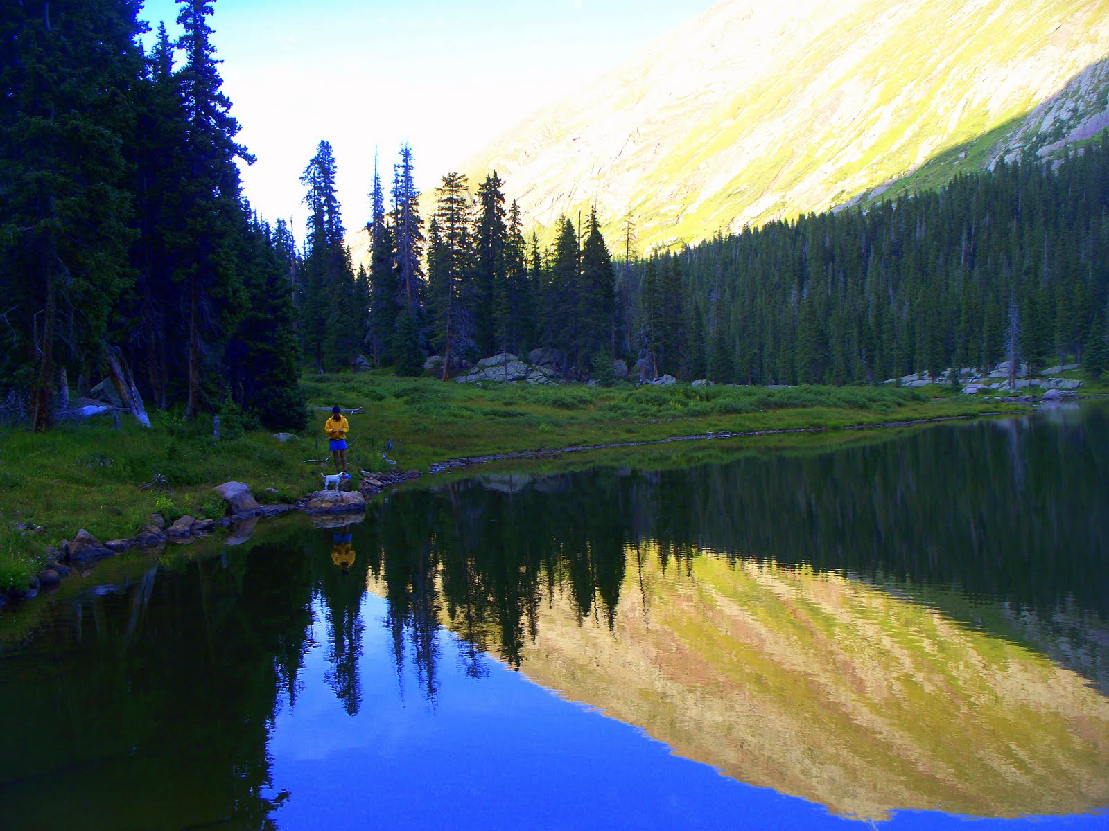
July 23rd section #8 13.4 miles 6 hrs-4020 elevation gain
With the Guller drainage on left side I started to climb to the Searle Pass. Both sides of the trail was covered with wild flowers that looked like a Sierra Club calender on steroids. A black bear was digging feverishly into a small patch of snow from last winter. I hope by interrupting his breakfast that he wouldn’t take it personal. The bear was a blur as it barreled into the willows that folded around him and it made a zipping nosie as he disappeared. The red color of the sunrise, turned six bull elk silhouetting images on the crest of the mountain. All six elk turned in unison like ballet dancers and made a fast retreat. The morning colors of reds and yellows on their fur made for a special moment like I was the audience for their performance. The most expensive camera couldn’t have captured the feeling nor the moment. From the pass I had a million dollar view of the Mayflower mountains with it’s castle like spirals in the distance. The trail followed the ridge and it would lead me to Kokomo pass.
The trail lead me down to the Cataract Creek drainage but it was still very much in the open. I came to small bronze marker that marked some young fella last place he stood on this earth. I imagine it was a lighting strike that clobbered him being in the open like this. It reminded me of the time I was hiking in the Gore range by Kremmling, Colorado. I came to a full size tomb stone planted right on the point of a ridge. Later when I worked my way back to my truck I flagged down a lone pickup truck and had a few questions about this memorial. “That was Bob’s favorite spot while hiking for elk.” this fella explained. “Was it hard to get approval to bury him their?” I asked. “No Bob was pretty quiet while he was alive and even quieter being horizontal like that!” he said.
The tall timber was a welcoming sight especially with Cataract Creek winding it’s way down the mountain . As two hikers came towards me I felt a pull on my pack. “Where do you think your going?” ask the one fella with uniform. “Durango is my final destination.” I said. “Well Durango is going to have to wait a few hours.” the man said. “The Federal government has hired my company to clean up old Camp Hale from unexploded munitions.” he explained. “While the men are searching and cleaning up the area, no hikers can enter the area.” said Scott the worker. Scott said that the 10th Mtn Army trained here for the Second World War and they have found
 enough unspent munitions, to start another war. The other fella with Scott was a CT hiker like myself. He was a retired veterinarian was from Avon Ohio and was having trouble with the lack of oxygen do to the elevation. He had hiked the AT three years ago and liked the oxygen content a lot better back east. “How many days have you been walking?” asked Jim the vet. “This is my eight day, how about you?” I asked. “I had thoughts of us walking together but it’s taken me eighteen days from Denver.” he said. While we waited for the all clear from the bomb squad, we talked about resupply. Jim had stopped at Burger Kings on the drive from Ohio and picked up empty pickle containers. Than he put his food in the containers and hung them from trees at different trail heads.
After cooling our heels for two hours we got the all clear from the contractors working the firing ranges. We all walked down to the dirt road that would lead us to the CT. A woman ranger and the foreman of the job meet us at his truck for transport. The ranger asked Jim and myself some simple questions, but mostly she was interesting in talking to the foreman. Not that he was better looking than us but his company paid better for next year. We got a quick tour of the area with machine gun nest on your right and soldier barracks on your left. As we approached a group of younger workers, one of the fellas flagged us down. “What does this flashed red light mean on this metal detector?” asked the fella. “That means there is a severe lightning storm approaching.” said the foreman. “It will only stop flashing if you get struck or the lighting passes through.” said the smart ass foreman. “Do you think we should keep looking for munitions?” asked the young worker. “Sure if you want to get struck by lighting and blown up at the same time, but filling out the accident report can be a bugger.” said the foreman. As we drove away I saw all the workers
 heading for the high timber. Jim had told me before that he wasn’t a big fan of lighting storms and the past conversation didn’t help any. The truck stopped at the trail head and Jim and I got out. It was only 2:00 pm but Jim wanted me to help him find a campsite that was lighting proof. I dropped my pack and walked along a old dirt road until I came to a old miners cabin. I help Jim get set up and then said my good byes.
I wanted to put on a few miles before dinner time, even though there was a chance of rain. I stopped as the skies opened to a small drizzle of moisture, to put on my pack cover. A couple
 from Durango just happened to walk by at the same time. “Are you walking to Durango?” asked the lady. Finding out I had walked 116 miles in 8 days, she started to shake her head. “That’s all the farther you have walked, in 8 days.” she said. “In five years I am going to walk the whole CT.” she announced. My pack seemed to get heavier and my ego just sprung a leak. “Good luck on your five years plan.”I said, as I waved them goodbye, but not all my fingers where up.
I crossed the road that lead to a memorial to the 10th Mountain Army on Tennessee Pass. I continued on the CT and came to the fork of the Tennessee Creek which had a great spot for a camp site. Even though the lady from Durango thought I should carry on, I ate dinner and fell asleep.
July 24th Section 9 /11.5 miles/6 hrs/elevation gain of 2,120 feet.
I awoke to clear skies without the least bit of sign of dark clouds of lightning. Pam my wife was bringing supplies from Denver and I was going to rendevous with her at Turquoise Lake. As I entered the Holy Cross Wilderness Area I meet another group of CT volunteers, working on the trail. A lady from Texas with a strong accent to prove it, was issuing out work orders. “If you want to drop your pack for a few hours, we could sure use someone with a strong back and a weak mind!” she explained. “Boy I fit that bill, but I have a date with my wife.” I said. Large stones were being man handled by a group of strong backed guys as I worked my way through the crew.
As I sat on a large rock by Porcupine Lake a column of Boy Scouts, came marching down the trail. A husband and wife team from Breckenridge was leading this group to Half Moon for a merit badge.

Two hours later I came to another group of young hikers, from all over the world. They were on a mission to learn about nature and each other.
With a sigh of relieve I could see Turquoise Lake in the distance. The trail seemed to be a lot easier since I could see my objective and it was down hill. I met another group of hikers, lead by a young hiker. They were also from all over the world and where headed to a cabin called Uncle Bud’s. The seven hikers were walking with a brisk pace, except for the Japanese hiker leaning against a tree. “How far is Uncle Bud’s?” he asked. “How far did your leader say it was?” I asked. “Two hours.” he said. “I would stay with that answer, sounds about right.” I replied. Come to find out they had stayed at the Skinner Hut last night. The trail down from there can be quite
 steep, except they hitched a ride around the hard part.
I was sitting against a rock waiting for my Knight in Shining armor, named Pam to show up, when I heard a voice. “Does the bus to Leadville stop here?” asked a lady with curly hair. “Not in your wildest dreams would a bus stop here!” I explained. I found out this German woman needed a ride to Buena Vista. Her German name was to hard for Yanks to pronounce so she went by Curly. She had walked the AT and PCT and now was doing CDT. She had meet her husband in Germany when he was stationed there. His big adventure was walking the aisle of the local Walmart on Friday night. Curly was suppose to be home but had called her hubby three time and changed her airline ticket back home, after she had finished a section of trail. She was going to meet friends in Buena Vista and then call him again for a fourth time. “ What if wants you to come back home to Maine?” I asked. “I’ll go home and wait for him to die!”she said. I thought to my self, spoken like a true German! Pam showed up at the same time as the Boy Scouts did. Come to find out Curly and the Scouts were both asked by the Japanese hiker, “How far is Uncle Bud’s hut?”
Buena vista was on our way to Salida, so we dropped Curly off at her friends house. Pam by accident had brought over a wrong container of the food that we would cache. So we decided to bury the one container and I would take one with me. Then Pam would come back the next weekend and meet me along Highway 50 at the Monarch Ski Hotel.

We drove to CR 114 and then followed a dirt forest road for several miles. I found a place where the CT would meet this road. Under a grove of aspen trees where the dirt looked soft I dug a hole deep enough to drop my 5 gallon paint bucket, loaded with food. I placed a rock on top as a marker. Since we had some extra time we walked along the CT heading north. After a few minutes of walking we meet a couple with dogs walking towards Creede, on the CT. They had started at Buffalo Creek since dogs aren’t allowed in Waterton Canyon, a month ago, and had the saddle sores to prove it. While I was talking to the lady, her husband laid down beside the trail and fell asleep. The two dogs weren’t in any better shape, as they laid beside their master. He was a dentist on the Apache Indian reservation in Arizonia, while she did library work. As we talked dark billowing clouds began to form towards the west. Thunder could also be heard over the sound of our feet hitting the path, as Pam and I made a dash for our vehicle. After 15 minutes of intense rain and wind, the skies cleared. I knew our new friends were needing more words of encouragement, so I blasted the car horn as a signal. Within a few minutes they came out of the timber a little worse for wear. I had seen a great camping spot along the dirt road so
 we offered to drive them down to it. The wet dogs and hikers all poured in to our Jeep. Before we left them at the site, I handed out much needed fresh fruit and candy.
Pam and I made a plan to hookup again in five days along CR 50. That gave me five days to walk 85 miles, I hope it doesn’t rain much.
July 26th section #10 4.4 miles 45 minutes
As we walked along the streets of Salida I noticed black clouds forming over the mountains. I had one last stop at a local grocery store, where I noticed a woman’s ring ahead of me in the check out line. I found the story behind the ring, kind of interesting. Her late husband was station in the Phillippines during the war, and one night as he walked along the beach he spied a oyster shell. In the shell was this huge pearl and he kept it all thru the war. Back at state side he had it made into a ring and presented it to her after he ask for her hand in marriage.
Pam had dropped me of at the Hagerman Pass trail head, just as the storm number one hundred started to make it’s presence known. I wanted to find a campsite before I became another lightning victim. I was able to get under my tent flaps before the storm released all it’s moisture.
July 27th section #10 &11 19.6 miles elev. Gain 1,760.
Woke to a drizzle but it was only enough to keep the dust down. The Mt Elbert trail head was
 wide enough to drive a tractor trailer thru. Millions of people most have used this spot as a sending off point for the highest mountain in Colorado. I was reading a sign at the trail head when a group of people, three strong walked by, heading north. “That’s it, we are heading home!” said the leader. “Where is home?” I asked. “Denver is where we started the CT and Leadville is where we are going to finish, I can’t take this lightning!” he explained. It hadn’t been lightning for at least forty five minutes, I don’t know what his problem was!
As I turned around forty Boy Scout came marching down the trail with ten leaders behind them, all shiny and smelling fresh. Well at least everybody isn’t throwing in the towel. I hope all those badges on their chests doesn’t attract the lightning!
After lunch I was walking down into the Twin Lake area, when you guessed it, dark clouds off the mountains. I was totally in the open without even a prairie dog to hide behind, when I heard the first boom from the clouds. Half way around the dam I found a Water dept building and leaned against the dry side of the building till it was all clear. With one eye towards the heavens I made a mad dash for the trees. A few fool hardy picnickers and fisherman where still sitting on there chairs starring at their fishing poles. I pulled my rain fly from my back pack and tried to cover my body as fast as I could. After a few minutes of a steady down pour it was all over except for the crying. I was close enough to the lake shore where I saw plenty of that from the children being pulled through the mud back to the safety of their cars by water logged parents.
I ate my dinner and watched the sun set over the western mountains. Another day and still alive.
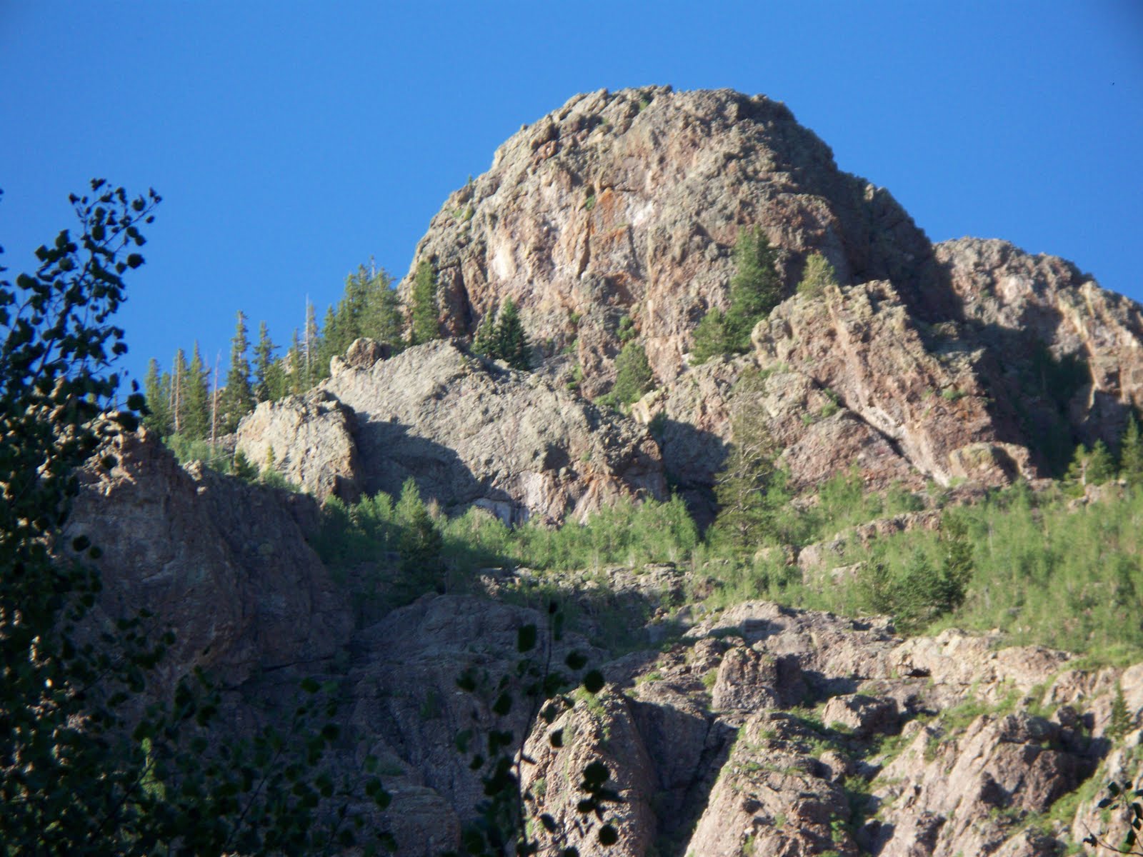
July 28th section #11-12 15.9 miles elev gain 4,520
This morning exercise called for me to follow the trail down to Clear Creek valley. The trail was a series of switch backs that would lead me down to CR 390. The signs and trees of the parking lot became a haven for wet hikers to hang back pack equipment to dry after yesterday’s storm. An older hiker and his cousin from Ohio had gotten caught in the yesterdays gully washer and had tents hanging in the morning sun. The pair wanted to follow the trail up to Mt. Missouri but their legs seemed to have other ideas. As we talked I could see a small wooden bridge spanning the creek across from the parking lot. A couple of kids wearing life jackets where having fun around and under the bridge. The girl came up to us with her hands cupped around a small bird. The boy came over looking for ideas of something he could capture, that wasn’t to dangerous. I suggest looking under rocks in the creek for creepy crawlies.
After I crossed the bridge the trail took a change with a steep ascent up and over Waverly Mountain. A couple from Capital Hills, Denver where sitting along side the trail with their shoes
 discarded beside them. They had been walking for thirty days from Denver and were looking forward to a soak at Mt. Princton Hot Springs for maybe two days.
I stopped by a clear stream and was gathering water in my water container that hangs inside my back pack, when a hiker named Denny walked up and introduced himself. Denny was from Texas and he also had Durango on his sights. I was so busy listening to Denny, I didn’t close my water container good enough. The first step I took up the hill, the water container turned into Niagara Falls, right down my back side. The weather had been hot so it actually felt refreshing, except my undies where a tad uncomfortable. Everyone had the idea of Rainbow Lake as a camping destination for this evening. I met up with Denny again as he was soaking his aching feet in Pine Creek. “Hate to breaks the news to you but it’s beginning to look like a storm is planning on ruining your soakathon!” I said. “If I just can have a few more minutes, please mister please!” yelled Denny. It was two mile hike up the lake and I was moving as fast as a sore legged hiker can move. I had just set up my tent, in record time when the first volley hit. Hail follow by a side dish of sleet and lightning for desert. I was laying in my tent listening to the weather turn my tent into a tom tom drum. Like most summer storms they don’t last long, just long enough to soak everything left unprotected. This include poor Denny, who showed up fifteen minutes after the storm passed wearing a Texas A&M sweat suit. He had left his pack at the bottom of the last hill, since he want sure where Rainbow Lake was located. After a few minutes Denny came dragging into camp and dropped his pack with a thud. “I know we aren’t allowed to have a fire
 without a official fire ring!” said Denny. With a wave of his hand like a priest would do to bless a church member, Denny declared this a official fire ring and let the fires begin. Denny was very conscience about the weight of his pack and he carried five days worth of food in a gallon zip lock bag. We talked around the roaring fire for several hours, mostly about the CT and the sights that we where seeing. I told him about some of my back packing in New Zealand. “ I imagine if you like this trail Denny, you will really like NZ.” I said “When I get to Durango I”ll sell all my camping gear, to the first person that has cold cash!” he said. “I only do things one time, like sky diving and deep water scuba diving, then sell the gear.” he said. “If I keep my gear I may really get into back packing and I don’t like back packing!” he explained. Denny explained that his niece Ann had started with him in Denver but had to pull out for college at A&M. I guess the way Denny tells it Ann was a ball of fire as a teenager. Ann never got along with her mother and as the years went by it only got worse. One morning Ann’s mother went to wake Ann for school, but she was AWOL. The whole community looked high and low for Ann. Two years later Denny got a call from the Texas Highway Patrol, Ann had been found. Two years ago when everybody and their dog was looking for Ann she had sneaked across the Mexican border without any paper. Then she hitched a ride to Guatemala and lived with a family she met there. The village didn’t have a phone and had a public shower when a janitor would fill a tank in the morning and the people of the village would then use it. After two years she felt like she needed some education, so she crossed the border again. Ann ended up living with Denny and his wife since she still didn’t see eye to with mom.
Denny also was full of information about the hikers behind me. The three amigos that were being escorted by Mom had been walking with Curly. Until one of the hikers ask Curly if she was the seventy year old hiker they had heard about, she was sixty. The vet from Ohio had taken a few days off in Leadville. Josh the Jay Bird was still trying to do 25 miles a day with a small pack and sucking water from muddle puddles, so he wouldn’t have to filter it. Denny was a later riser, so I said my good night’s and good bye that night.
July 29th section#12-13 19.2 miles 8 hrs elevation gain 3,720 ft
The trail landed me in the middle of North Cottonwood drainage, with groves of aspens as my companion. The trail then turned into a series of roller coaster until I landed at South Cottonwood Creek. I found a level site and pitched my tent without being soaked by a summer rain shower.
July 30th Section #13-14 19.5 miles 8 hrs gain 3,320 ft
The trail was bring me closer to civilization, I could tell from the width of the path. Plus the no trespassing signs out numbered the wild flowers. I could see Mt. Princeton and I knew the world famous hot spring where close by. I stopped in at the store for a ice cream treat. “Is your wife in the hot springs with a twisted ankle?” asked the clerk. “No my wife is at home, probably twisting a lime in a tall cool drink about now!” I said. The idea of laying in a hot springs did sound
 tempting but I had to put on miles. The CT followed the CR 162 for a few miles and then I came to the official trail heading south. It must be about 2:00 pm because here come the afternoon thunder storms. I was in a open field, without a tree in sight. I found a dry creek bed and pulled a tarp over my head and had lunch in the lowest spot for miles around. After a few minutes I heard a bicycle pull up and the man asked if I needed anything. I thought I just need you to get away from me with that lightning rod steel bike. I watched as he rode north and cressed a hill, as thunder was rolling in the valley.
I walked into a large meadow that was surrounded by beetle killed trees. I could hear a TV at a very high volume, coming from a group of travel trailers. Being parked in a circle helps ward off marauding Indians and it’s also easier to hear Jerry Springer on the tele. Between the generator running and the television, I had enough of civilization for this week.
I followed ATV tracks to the Brown Creek trail head. ATV aren’t allowed on this section of trail so I was wondering if I was going to run into this rebel without a clue. I found a camp above the
 creek, that had also been found by swarms of mosquitos. I found the mother load of all mosquito families. I ended up swatting anything that moved while I ate my dinner. The mosquitos where so big when I killed them I could hear their bones break!
After dinner sitting on the hill above the trail I heard a group of people huffing and puffing as they ran by. Than came another group of three, with their eyes on the rocky ground and their arms and legs swinging in unison. A few minutes late came a older fella, that had the spirit, but his energy was back in his truck. There was a fork in the trail and he stopped and started down the wrong trail. Like the Great Spirit in the sky, I yelled, “You’re on the wrong trail, they went that away!” The toasted runner immediately turned around and went down the right trail, with
 out even looking up. I walked down to the fork in the trail, and was looking at the flaunta and flora, when the older runner came back up the trail. By this time he had turned into a walker. “Every week I try and keep with this running club and I either fall behind or get lost or both!” he said. “I am walking back to the trail head and wait”, as he started down the wrong trail again. I only had to say stop when he knew he had done it again and turned around without saying a word and got on the right trail. Come to find out, from this runner that the ATV tracks I saw, belonged to the local Search and Rescue. A hiker on the CT had gotten tangled up with some roots and had fallen off the trail and had broken his leg. They had put his broken carcass on the vehicle and carried his butt to the hospital.
July 31st section 314 13.6 miles 6 hrs gain 3,320
I love the smell of aspen trees in the morning! The CT crossed the trail to Mt Shavano and on the sign post was a small note. “I have lost my camera with our honeymoon pictures from the Phillpines, if found call Ph 000.” This would give me something to do , besides looking at my feet and watching for ankle turning rocks. Within a few minutes I noticed a stretched out body on the
 trail, must be a homicide or a tired CT hiker. Dave answered when I walked up to him, so he must be a walker. Dave was originally from England but came to Boulder to climb the mountains but never went home. His wife was meeting him along the trail, that is until she found out she was expecting twins. Maybe that’s how she got pregnant, anyway the doctor advised her not to drive in the mountains. Dave got a friend to meet him at Marshall Pass with supplies.
A couple more miles down the trail, I noticed a woman with a tape recorder and a megaphone. This rangers’s summer job was to count Red Tail Hawks, which sounded like a great job. She would turn on the recording of a hawk and wait for another curious hawk to show up. This past month had been tough without much in the way of hawk showing. She ask me if I had seen any from Denver, which I hadn’t.
Dave caught up with me and we walked together into a clearing, that had a large white tent in the center. Dave got really excited, because he knew these folks as private outfitters hired by the CT. The outfitters would help CT hikers along different sections of the trail. I get real excited to when I smelled food cooking. Dave and I sat down to a lunch, the one we didn’t have to carry, supplied by the out fitters. I found out they were heading to Marshall Pass and would be there Sunday night, along with Dave.
After lunch Dave and I walked along the last ridge before CR 50 and you guessed it a storm came up with loud lightning and thunder. Tall steel towers holding electric lines dotted the ridge.
 I told Dave he could put his tongue against the steel pole and he wouldn’t have to worry about any more kids. With rain falling Dave and I walked a briskly to the road. I wanted to hitch a ride to Alpine Lodge to meet Pam, which is a few miles west. “ What do you think your chances are of getting a ride in this rain storm!” Dave explained. Just than a jeep made a u turn in the middle of the road and rolled down it’s window. It was Ma the woman that I had met eleven days before at Cooper Mountain. She gave me a ride to the lodge and I kept dry.
After meeting Pam we took a ride to Salida and we where able to return the favor. As I drove down the highway I noticed a hiker coming out of the woods and it was that Texan, Denny. We picked him up and took into town for a meal and a hot shower.
The next day Pam and I took a short hike to a water falls along Brown Creek. The falls was very nice but the most interesting happening was the hikers we meet. The four hikers that I had meet at the CT office in Golden were camped along the trail. They had stopped and climbed Mt Elbert and then they where going to continue on the CT.
Aug 2nd Section 15 14 miles 6 hrs el gain 3,440
Pam and I enjoyed the morning together as we drove to the Marshall Pass trail head. An older gentleman was fishing off a dock that extended into Fooses Creek. I walked up to him with my pack on because I was curious about the fishing. “Where are you going with that big pack?” asked the fisherman. “I am heading to Durango on the CT.” I said. “I always wanted to walk that trail and bragged that I had.” he said. “Now I bearly have enough strength to wrestle a night crawler on my hook.” he explained. “Remember don’t put off any of your plans, do it now!” he said.
Seems like everybody has a goal or objective, mine today was to be on Marshall Pass by dinner time. The CT outfitters barbequed chicken and I had date for dinner. I had a fourteen mile hike ahead of me with 3,440 feet of gain, so it wouldn’t be a cake walk. I smelt the horses before I saw them in the trees. A couple of forest service guys where doing there best to load up the pack
 horses with maintenance gear. The horses on the other hand or hoof where doing their best to keep the heavy gear off their backs. Every once in a while the horse would give a few bucks and a pot or pan would be air born and land with a clatter. I kept walking realizing I couldn’t help and would probably just make things worse. After a few minutes the trail ended so I turned around to ask directions. “Oh you’re on the right trail just keep going!” the wrangler said. I think I should have asked the horse because the trail got worse and worse the farther I walked. I climbed the side of the mountain and when I looked down I could see the trail and it was on the other side of the creek. I hiked down to the creek and the trail was a beauty. At 5:00 pm I came to a fork in the trail and decided to take the right fork but it was the wrong trail. I back tracked and ended up at the outfitters camp site at 5:45 pm and was handed a beer and chicken. We talked into the night about lightning and the CT.
Aug 3rd Section 16-17 21.4 miles 11 hours elevation gain 2,840.
I had 21 miles to put behind me today if I was going to camp at Baldy Lake. The morning didn’t start off just right either for that kind of mileage. The trail turned to the left and I just kept on following it , that is until it stopped at a over look. I had to walk back and tried to make myself invisible to my outfitters friends, since I didn’t want to look like a fool.
At Sargents Mesa I found some water where there isn’t suppose to be water. I could hear the sound of a vehicle banging it way over a very rocky road. The young couple where from Salida and they where out exploring the country side and each other, I imagine. They had some snack food on board and we shared some food and information. I still had 7 miles to get behind me so off I went, I didn’t imagine they needed my help anyway.

At 6:30 pm I had made it to the trail head that lead down to Baldy Lake. The trail was steep and very rocky, but I managed to make the lake by 7:00pm. I noticed a couple of fellas sitting by the lake with a dazed look on their faces. As I set up camp one of the guys walked over and sat on a log. “How far did you walk today?” he asked. “21 miles.” I said. “My Lordy, we can’t and will not make that kind of mileage!” he said. Come to find out the couple had been walking the CT, but his partner had twisted his ankle and attitude. They had originally planned on walking to New Mexico, but Creede sounded real good at this point.
After dinner when the sun was setting, the one fella with the bum ankle came hobbling over with two food bags.”Do you want to hang your food with ours, from the bears?” he asked. “No I usually use my food bag as a pillow.” I explained. I noticed both of the hikers talking afterwards and kept pointing up at my site shaking their heads. The last straw was when they found out I get up at 4:30 am and they had plans for a 9:00 am rising of the dead.
Aug 4th sec 17-18 /22.3 miles/ 9 hours 2,440 elevation gain
I awoke with the morning sun reflecting off the lake and making sunburst shadows on the rocks
 and trees around the lake. One of the hikers was actually awake and standing gathering in the suns warmth when I left my camp. It was a steep climb out of the valley but it was very rewarding with a view of the lake below. Toady I would locate my food cache if the bears didn’t get there first. I was real excited about finding it and real sad about having to carry 12 days worth of food. A drunk with out a sense of direction must have made the trail, because it just seemed to wonder all over the mountain side. By late afternoon I made it to the top of the mountain and as I walked into a clearing I recognized the aspen trees that held my buried goodies. Everything was as I had left it. I dug out the container with the enthusiasm of a kid at Chrsitmas, hoping he got a pony. I had packed extra Snicker candy bars and I wonder how many I could eat before my eyes rolled back into my head. I loaded up my pack and man did it feel heavy, even with six candy bars in my belly.
I crossed the paved CR 114 without a sign of any cars or people. There was a gate that kept cattle from being a hood ornament on th highway and attached to it was numerous notes. One was from Josh the Jay Bird, he was heading back to Denver, never to return. I was going to miss old Jay Bird, even though I had never meet him. The dentist and his wife had left a thank you note for Pam and I.

The color of the vegetation and the patterns on the butterflies wings where changing the farther south I walked. By 5:00 pm I crossed Los Creek and found a good spot to camp. The creek should have been called Lost Creek, because the water was just trickle at best. I had to dig a hole and let the water seep into a container. I looked up and saw elk waiting his turn at the stream.
Aug 5th section #8 and what ever- 20 miles 1,220 elev gain.
Little did I know what was ahead of me on the trail today, the perfect sunrise didn’t give me a clue. In my data book it mentioned a cattle road and a gate, little did I know there was two, one on the right and one on the left. I picked left and thought all was going well, when I came to a gate. I continued and came to a road, which I should have but I was 3 miles south of where I should have been. I stopped a rancher that was more lost than I was but at least I knew it. I could have hitched a ride on the road but no I wanted to continue with the idea that I would cut over on a side trail and reconnect to the CT. At lunch time I came to a camping area with real people and real maps. I found out that I could cut over to the CT by following back roads and trails. I continued on my quest and was helped along by two girls in a jeep. I was looking for trail marker 744, as we drove along the dirt road. Within a 45 minutes we drove into a clearing that held the drivers brother. Her father had already taken a group of horses into the back country site. As the brother explained to me about how had already passed the 744 marker, his sister
 laid a fishing rod against the horse trailer. The rod fell over and whipped the horse tied to the horse trailer on the butt. The horse got completely spooked and started to kick it’s rear hooves in the air. The horse came around in a circle of kicking frenzy. The horse’s hooves started at the back and worked it way along the trailer. The hub caps and reflectors became targets for the horse shoes. Hub caps and reflectors where flying through the air and landing in the scrub brush beside us. The horse being tightly tied to the trailer is the only thing that saved us from this mayhem.
I returned on the road and found the 744 marker, that read, Trail maintained by roundup rider 1985! The trail had the look of not being maintained since that date. I followed it until I came to a junction of three trails. I looked for a passage through the mountains in the way of a pass. I saw a dip in the horizon and headed for it. I found a trail and came to a creek. I followed the creek and thought I had found the Cochetopa Creek since there was giant rock cairn marker. I camped
 right along the creek with a idea of getting a early start on my way to San Luis Pass tomorrow morning.
Aug 6th no where/lots of miles/lots of gain in elevation
As I was eating my breakfast I thought about my climb over San Luis Pass today. I was climbing over the pass on the continental divide when I noticed a herd of elk as they disappeared over the edge of the mountain. Within a few hours I came to a elk that wasn’t as lucky as his buddies and had been struck by lightning. The crow and ravens where making the most of his bad luck as they feasted on the elk for breakfast. The storm clouds started to appear as I hiked by a alpine like. The trail lead down to a willow covered valley, when the heavens opened up. I sat down in the willows and covered my body with a tarp. As I lay under the tarp to protect myself from the hail, I could hear hikers screaming and running on the trail across the valley. After the storm pasted I walked down to the valley as the wet hikers meet me at a stream. Just a few minutes ago these hikers where covering themselves with rain ponchos and trying to crawl under a rock from the lightning strikes. The first group of hikers still had ponchos blown over their packs. “Have you come from CR 149 on the way to Creede?” I ask. “Our leader has the map and he is bringing up the rear.” said the hiker. We looked over the map and I realized I had gone up South Cochetopia Creek instead of North, bummer. It had taken me over 9 hours to get to the wrong spot and I wanted to make it back to my original camp site. I had a Snicker bar for fuel and nothing but time. By 6:30 pm I made it back to my campsite and luckily the weather held out.
Aug 7th Section #20-21.1 miles/10 hours/2,960 elevation gain

After some bush wacking I found the CT and the North Cochetopa Creek. The CT marker was on every other tree and it was a big relief to a lost hiker. I started to met some other hiker and found out some information about the trail and them. The first lady has hiked this section before and really enjoyed it without her husband getting under her hiking boot. She also told me about a fella from England named Dave that was just ahead of me. As I climbed over the pass the daily thunder storm came to meet me. I had a view from the top and I saw Dave walking fast towards the timber. I yelled and he looked up but it didn’t slow him down for a second from the lightning bolts. I ran down the trail and met Dave as we got into the timber. Someone had tied large tarps to the tree branches and we where glad to get out of the wet. We sat under the shelter as a group of young hikers started to come and sit my us. They where from a church in Tulsa, Oklahoma and where on a state wide vacation. They had just arrived in Creede last night, so lots of the students where a little tired, from hiking and the high attitude. One kid stood up so all could see
 him and he said. “I am not carrying that pack another foot!” as he dropped his pack. “Without missing a beat the leader said. “Very interesting!” Dave and I slipped away from this high mountain soap opera. Dave was going to walk into Creede and wait for his resupply. I would walk onto a camp site along Middle Mineral Creek.
Aug 8th/section 21-22/19.3 miles/8hrs/3,200 elevation gain
Giant pinnacle rock formation along the trail that pointed towards the sky, would lead me to Snowy Mesa. The Snowy Mesa is a five mile long tundra covered landscape that looks like it could be from Outer Mongolia. I could see storm clouds forming over the mountains that surrounding Durango. The area didn’t have a bit of protection from lightning for miles, except rock cairns that where eight feet tall. As I crossed CR 119 there was parking area with trees and picnic tables. At one of the tables sat a couple from Texas that where so glad to hear about back packing, that the woman wrote down ideas about gear. After saying goodbye to my new friends, I turned around as a car pulled into the parking lot. Three people got out of the vehicle and one of them looked very familiar, it was Curly, the mega hiker. She had hooked up with a German
 friend named Nancy from Denver and they where going to hike towards Wolf Creek Pass. Nancy’s husband would drive to Wolf Creek and pick them up. They begged me to have a early supper with them, which I knew could take some precious time from setting up a camp site later but it was food. After eating I started to get my pack on and getting ready to hit the trail. “Wait we have to help Nancy’s hubby set up his tent.” Curly said. Curly whispered that her friend’s husband was completely useless.
By the time we got on the trail it was already late in the afternoon. As we got on the trail the skies started to cloud over with a distant boom of thunder. Nancy was deathly afraid of lightning and she wore a crazy hat, that was suppose to ward off lightning. Curly on the other hand walked right out in the open as we headed for high timber and continued to the crest of the hill. “I want to check on the storm!” Curly said. “We will put that on your tombstone!” I said. With lightning strikes all around, now I know how Curly got such a curly mane. I continued walking after the storm passed, because it was getting late and I needed to find a site with water. I left Curly and Nancy in my dust as I went over a summit that had a antenna on it’s top. The hill side was also covered with hundred of baaing sheep. Two sheep dogs and their owner walked out of their camp site to see me hike by, which must have been quite a sight. Since I was pushing so hard
 and had got a nose bleed, that ran down my cheeks and dried. I could be a star in one of Stephan Kings movie’s with my face looking that way. I didn’t have any water to clean myself up. I found a small trickle of water as I walked, except the dark of the night gave me only enough time to set up my tent and not walk back to gather water. Like Scarlett O’Hara would say “I’ll think about it tomorrow!” So I slid into my sleeping bag with a bloody face.
Aug 10th Section 23-24 17.1 miles/9 hrs/4,460 elev gain
I am so glad I didn’t look for the water last night, I could hear the trickle of water in the willows but physically couldn’t find it. After lots of cursing and praying I found enough to wash my bloody face and have a few swallows to spare. A group of elk where hanging out above the willow probably waiting their turn at the trickling water.
I was slowly climb the highest part of the CT, at Carson Saddle. I stopped to have a snack and a look at the scenery, when I noticed a whole heard of elk running towards me. The small drainage below me funneled the elk through a narrow slit between two rocks. For ten minutes I watched elk as they took turns walking between the two rocks. I thought I had died and gone to Africa. I continued my hike when I came to the reason the elk had been pushed my way, a mountain biker. He didn’t have a clue that he was the ram rod on the this elk drive. A little later I got a
 extra treat when I found a four power bars in a plastic bag that must have fallen from a mountain biker back pocket.
Later I walked down into the drainage of the Rio Grande River and discovered a couple from Del Norte looking for moose. I know where elk are but moose I couldn’t help. They had nothing but good thing to say about Del Norte and the surrounding country side. After lunch I met a group on motor cycles from Durango, that couldn’t believe I had walked from Denver with the pack. The leader of the pack said he had bought a back pack and all the gear but after one trip he thought his back was going to snap. The expacker took all the gear to Durango and sold it and then bought a motorcycle.
By 4:00 pm I was crossing Pole Creek when my usual friend the summer storm showed up. I found a nice tree with huge over hanging branches and pitched my tent. I lay on my pad dozing in and out of cat naps to hear thunder and rain drops on my tent.

Aug 10th section 23-24 17.1 miles/9hrs/4,460 elev gain
Woke to clear skies, but everything was soaked with dew and from the rain storm last night. The trail looked like a Sherman tank had gone down the path before me. It was a herd of cows and the soft dirt got churned up by their hooves. The gate had been knocked down and the cows where on the side with the greener grass. One bull was giving me the eye and stomping his hoof but I just kept on walking. As I crossed the Rio Grande river a group of campers where standing around the tables with the food ready to be prepared. One fella came down and started to tell me about his friend George. “George walked 30 miles on the CT!” said this camper. Just then his wife walked down and told the story teller that they where all waiting for breakfast. “I was just telling this hiker about George walking the CT. “Said the camper. “Yea that’s right he walked 30 miles and then came home to soak his feet, he never finished!” she said. On that note the man sheepishly walked over to the fire and started to fix breakfast.
At the abandon Beartown site a old battered jeep was parked with an even older driver sitting inside looking at a map. “Have you seen any elk as you have walked ?” asked the man. “I am trying to photograph animals without much luck.” he said. I found out he spent his summers in Silverton and had just taken up the hobby of wildlife photography, except the animals weren’t cooperating. “If I where you I wouldn’t camp out along Elk Creek that’s just ahead.” said the man. “I have heard of people getting sick from the water.”he added.
I walked over the mountain crest and than started down the Elk Creek drainage. The view was
 perfect with the San Juan Mountains as a back drop. I walked down to some trees for protection from the summer storms and found a spot by the creek for lunch. Groups of people started to walk by, from the Silverton Narrow Gage railroad which had a stop below. Hikers can get off at Needleton and hike to Elk Creek to be pickup or visa versa. Four hikers stopped to ask a few questions, they where cops on vacation from Texas. “ Have you seen any bear, don’t you get lonesome, and what about lightning?” asked the cop hikers.
I kept walking and crossed the Las Animas river and the narrow gage railroad tracks. A small boy was sitting by the track with his back pack laying beside him,’ Are you waiting for the train?” I ask. “No my parents went to find a campsite and I told them I am not taking another step!” he said. I met his parents as I walked across the suspension bridge. “There aren’t any camp site ahead.” said the dad. I just kept walking and climbed a small hill over looking the river and found a flat spot. And called it home for tonight anyway.
Aug 11th Section #24-25 17.1 miles 9hrs 4,500 gain in elevation
As I left the river drainage the trail was a cork screw, as it gained in elevayion. I came to a hiker laying across the trail. It was if he had just fell over in the middle of a step and went to sleep. Half of his body lay on the trail but his shoulder and his head where floating in air off the edge of the rocky edge. I stepped over this sleeping beauty and continued on my way. I could hear the main highway that goes over Molas Pass as the big tractor trailer went roaring by on the way to Durango. There is a series of lakes along the highway and I knew that a general store and camp ground was by the biggest one. I walked over to the store only to find out the owner had taken
 off for Durango. I sat down at a picnic table and took in the sights of the San Juan mountains and mirror images of the mountains on the lakes.
I was walking across a meadow covered with wild flowers, when I noticed a woman and man standing at the edge of a aspen grove talking loudly. Finally the woman walked off in a huff towards the aspen trees, while the guy just stood there. I walked up and he said, “Do you think there are bears in those woods?” “ I have walked from Denver and haven’t seen hide nor hair of a bear!” I said. Than the man had a ocean of questions, like why, where and how. As best I could, I explained the whole back packing thingy to him. As I was walking away and he was still looking into the aspen trees he said. “You know what you have on your back, it’s freedom, something I’ll
 never have!”
Little did I know that I would be in the middle of people wondering just what in the Sam Hill I was doing out here. I passed a few couples as I walked along a trail that was close to the main road. The shiney white shoes and the Gater Aid breath was a give away that these where day hikers. One couple from Dallas just about put up a road block in order to stop and ask me questions. But out of the blue like a lightning bolt the woman asked “Do you ever get tired of looking at the beauty?” Maybe these folks where doing something different then Gater Aid.
I had a lot of miles to put on and the skies where getting very dark and weird. I was working my way up to the mountain pass, when I got my first idea of what was headed my way. Ten large hail stones landed on the ground beside me, with a thud. I dropped my pack by a large stone and pulled out my tarp, and covered myself and the rock. It reminded me of a western movie where the soldier lays down next to his horse for protection as the blood thirsty Indians ride around him, shooting arrows. Only this time it was hail for thirty minutes straight. I started to get cold as hail started to pile up around me, I felt like a Seven Eleven Slirpy. The hail stopped for a few second and I stood up and pulled on a jacket and tried to cover my legs with a wind breaker. Within a few minutes the rain and lightning started. The lightning kept hitting on the ridge above like it was trying to find me but my blue tarp cover was throwing off the right range. One time the lightning hit behind me and threw rocks mixed with hail on the tarp. I wasn’t scared but I sure was thinking about my future! Then just as fast as it started it stopped. I stood up and the only ground that wasn’t covered with hail is where the trap was. The trail had turned into a river of muddy water. A black and white dog ran by me, like there was no tomorrow, and there almost wasn’t. I saw his master on the distant hill side and I shouted to him and then he would turn around to look but then he just keep walking. At the top of the mountain, that was covered with sheep, I found out the reason for the fella ignoring me, he was a Basque shepherd and didn’t
 understand English. There was so much hail I couldn’t tell where the white sheep started and the hail ended.
I just wanted to get into the timber and maybe start a fire and dry out. I saw smoke coming from a grove of pine trees. I ran down and found a group of young campers with a grownup leader. They didn’t seem very happy to see me and suggested I walk to the next spot seven miles down the trail. Which I as kindly as I could told them to put there idea where the sun doesn’t shine. I spread my cloths out on the branches around the fire. They had ridden the storm out inside one tent which was flat as a pancake on the ground. After hearing a few stories of my back packing everybody excepted me as on of their own. I set up my tent and we spent the evening sitting around the fire telling lies.
Aug 12th Section 25-26 23.3 miles 10 hrs 2,200 gain of elevation.
It was sixty mile from my tent to Durango and I was bound and determined to do it in two days. I found out from my data book that the next section didn’t have water for twenty miles, so that might prove interesting. Walking down a logging road I saw a mountain biker coming towards me at a fast clip. He stopped and told me he was going to bike to Durango in one day, so I am not the only crazy one. Around the next curve I met a woman hiker that was doing section of the CT, just the ones that looked interesting. I found out from her that the dentist and his wife that Pam and I had meet had walked past Creede and finished the CT. Later I walked into a picnic area with tables set up for mountain bikers. The owner of the biking company was setting out power bars and drinks for the bikers. Him and I sat and talked while I slammed down a box of power bars. Along Bolam Pass the ground was covered with ripe strawberries, that had my name on them.
I set up camp at Hotel Draw and my only worries was the lack of water. I had two liters to last
 me tonight and tomorrow’s fifteen mile hike before water.
Aug 13th Section 27-28 36.9 miles 14 hrs 4,800 gain in elevation.
Last day on the trail! I woke to wispy skies, but other wise a perfect morning. A couple from Vail where camped out along the trail eating their breakfast. They had started in Denver 44 days ago and so they wanted the trip to be over rover. Their tent was set up along the slant of the hill and I found out a pesky deer hooked on junk food, had chased them out of the woods last night. Within a few hours I heard the welcoming sound of gurgling water. I didn’t have to walk fifteen miles, I drank till I almost exploded.

I could see Taylor Lake as I came up to the summit of the mountain. A herd of elk where milling around the field below me. Straight ahead of me was Kennebec Pass and it was all down hill from here. A group of kids wearing tee shirts where stand on top of the summit, as dark clouds started to gather. I told them about the power of Colorado lightning storms but I might as well have been talking to a tree. I strolled off the peak and came to a road and I must have been quite the sight with a beard and grime covering what dirty hair didn’t. A group of hikers stopped me and ask the usual questions.
“I want you to meet my father.” said the lady. We all walked back to the cars and the trail head. The father pointed to a sign that explained the CT. “ I have always wanted to walk that trail and here you have done it, congratulations!” he said.
It was 12:00 noon and I still had 20 miles to walk, but it was down hill miles. The trail snaked it’s way down to the Fagler Creek. I saw a fella trying to come out of the creek bed below by climbing over rock and roots. I reached down and grabbed his extended arm and pulled him up. He was from Reading Pa and had been walking for 55 days. He was deathly afraid of getting lost so he carried compass, maps, CT book and GPS. “I need to knew exactly where I am at, all times.”

By 8:00 pm I was standing on the dirt road 204 that would lead me to Durango the promised land. I got a candy bar out of my pack and a head lamp. As I ate the candy treat I turned on the light and swirled it around in a circle as the first truck pulled up. The couple must have thought it was Martian landing craft when they stopped to find out what was happening. “I would like a ride to Durango if your going that way/” I asked. This couple from California had just come from Durango but agreed to give me a lift. The woman
 rode in the back of the truck which was smart since I hadn’t seen soap for a few days. They dropped me off at a motel and I hit the shower faster than a speeding bullet. I also found a scale and found out I had lost 35 pounds.
Now I had to get my skinny butt back to Denver. Dave Guzy had some business to do in Durango so he brought my bicycle down with him. I gave him my pack to take back to Denver by car and I rode my bike back home in five days.
In Durango I met Ma the woman that was helping the three amigos walk the CT. One of the fellas had gotten sick from the water at Elk Creek like the photographer had warned me about. Dave the English hiker had finished two days later with the remaining two hikers and Denny. The hiker from Reading, I met him in downtown Durango and we had lunch together

posted by vince vogel @ 8:18 AM
1 Comments
![]()

