Travels along the Grand Gulch


While visiting with Brian Foss at the REI map center on the Platte River, I became aware of the Grand Gulch on the Cedar Mesa in Utah. Brian, knowing that I liked to back pack into new areas suggested I look into this adventure. With my pocket a few pesos lighter after acquiring the Grand Gulch Plateau map, Brian started me on the right path.
On Monday morning April 5th I called the Bureau of Land Management, BLM headquarters in Monticello, Utah and for $8.00 I was able to obtain a permit to enter the Grand Gulch. From a web page I obtained interesting information in regards to this area. Cedar Mesa has the largest concentration of Anasazi ruins and petroglyphs or Indian art work, in the world. The Anasazi lived in the area for centuries and left the Grand Gulch area approximately 800 years ago. No one knows the reason for their exit, possibly the lack of water due to a prolonged drought. Hopefully I will not experience the same problems. The gulch is 51 miles long with many side canyons to explore and the possibility of finding an undiscovered ruin. The gulch ends at the San Juan River.

BLM recommends 9 days of travel to hike to the San Juan and back. That would require my pack to be loaded with 10 days worth of food. So I decided that the Collins Canyon trail head would be a good spot to cache half of my food.
I drove from Denver over to Cedar Mesa on Sunday, and arrived at the Collins trail head at around 3:00 pm. I had my extra food in a plastic bucket with a tight lid attached. I would have liked to walk down the 2 miles into the gulch and bury my goodies but I didn’t think it would be a good idea to be seen carrying a shovel. People would either think I was digging up Indian artifacts or burying my wife! After burying the container I put a old dried cow pie on top to mark the spot.

I drove to Blanding, Utah and checked into a motel were the clerk informed me that this was Sunday in Mormon country and not many restaurants were open. In fact just one, Subway.

April 12th Monday morning was a cool clear day with a forecast of 30 % chance of rain as Dave C., a fellow hiker and I drove over to the Kane ranger station. The ranger already had our permits but we where required to watch a 15 minute video about Grand Gulch before we could set foot into their domain. The video showed all the do’s and don’t of the canyon, mostly how not to get yourself killed or worse while back packing. Dave was only going to hike for 2 days, so we dropped his car at the Bullet trail head. Due to the winter snow pack, we found out it was a excellent year for keeping ourselves hydrated.

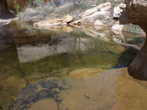
By 10:00 am we were walking down the wide mouth of the gulch. Being early spring the scrub oak weren’t showing any of their colors. The cedar trees were putting on a display of bright green and the sage bushes pleasant aroma filled the air. Within 2 miles we came to a small moving stream surrounded with patches of snow. As we passed a large frozen waterfall I was glad my back pack carried a few extra winter clothes. The next 5 miles were like walking through a history lesson on the Anasazi Indians. Cliff dwellings and ruins dotted the canyon walls. Along with the ruins we found information containers informing us about each site. Turkey Pen ruin with sticks protruding and a rock corral made a good stop for lunch. Unfortunately we had to settle for bologna sandwiches as the turkeys had long since left. My original plan had us camping at Bullet Canyon 7 miles farther up the trail but our extended stay at this site had us stopping to camp at the mouth of Todie Canyon. Dave was having mucho trouble with his boots and upon closer inspection it didn’t take Sherlock Holmes to figure out the problemo. The hiking boots were made with a steel toe for extra protection, but in this case the steel was biting his toes.

When we walked into Todie canyon we noticed a tarp covering several packs and food hanging from a tree minus their owners. After setting up camp and eating our dinner meal our wandering neighbors showed up to retrieve their possessions. The skies were getting darker and more threatening with the passing of time and it seemed unusual that our neighbors next door made no attempt to set up their tents. Dave and I went on a short hike and we had to walk through this odd camp. We discovered our new friends didn’t have jack for shelters but they did have Jack Daniels in the large economy size! Getting into my tent I donned long johns, got into my sleeping bag which was inside my bivey bag and felt like one of those Russian wooden nesting dolls! Come to find out I would need all of this protection, for as the midnight hour approached so did the wind and rain. As I lay awake listening to the hail tapping a tune on my nylon tent I wondered how the Jack Daniels dudes next door were doing, maybe they hooked up an IV!

April 13th- The next morning our neighbor’s sleeping bags and pads decorated tree limbs as they dripped their contents from last night’s storm. This morning’s journey would lead us through more ruins and the most interesting was Split Level Ruin. Along the trail we met a couple, Dave and Gussie Walter who were going to be out for 10 days. Their journey would lead them down the gulch to the San Juan river and then hike 4 miles along the river bank to Slick Horn canyon as a way out. It didn’t sound like a bad idea except I remembered that the San Juan’s banks were very steep.

Dave C. had over loaded his pack with the idea that the extra weight would help him loose a few extra pounds. It’s a plan that I have witnessed on the AT and the Colorado Trail. It’s just not a lot of fun carrying the load and especially in the heat of the day when it can be a real energy siphon. By 3:00 pm Dave had fallen behind and was no where to be seen as I approached a side canyon. I stuck my walking poles in the sand to let Dave know that I was going to explore this unknown canyon. I walked for 15 minutes when I noticed a group of people all staring at some wall paintings. Brightly painted characters decorated the canyon walls. I thought this might be Bullet canyon but I didn’t want to ask and look like a lost soul, which I was! Besides the group looked at me like I had invaded their secret garden. I found the metal box that contains information on the historic sites. I opened the box and lo and behold the contents told me that I was at Sheik’s Canyon. Letting Dave know that Bullet Canyon was only 1 ½ miles ahead was going to be a big relief for him and his mega pack. Dave and I met up after I came out of Sheik’s canyon. We hiked on to the entrance to Bullet canyon. This entrance is where two creeks have come together and that is where we set up camp. Within a few hours I could hear the women’s group I found at Sheik Canyon arrive and start to set up their camp. After dinner I walked over to have an evening visit with the women. The group was the Old Broad’s for Wilderness and they had planned this trip as a fund raiser. One of the grand ladies leaned over and whispered, “ I am not old nor broad!” Dave and the ladies would walk out together the next day by way of Bullet Canyon.

April 14th Because the searing sun can hard boil your head by 7:00 am, I said my good bye’s to my new friends and Dave and was on my merry way. My plans of camping at Step Canyon quickly changed when I arrived within a few hours. Davis and Jessie had spent the night at Step canyon. I dropped my pack and all three of us decided to do some bush wacking exploring in the canyon. The canyon floor was covered with willows and sage brush. The trail thru this mayhem looked like what a drunken rabbit would have laid out. This is true of most trails in the gulch as it is so over grown with thicket hikers have to just walk helter skelter. Back to our walking of Step Canyon, we followed the small creek for a short distance and then the trail headed up to a small plateau and then back to the creek. As we crossed the creek, the solid sand stone plateau seemed to offer the least resistence. We just kept climbing higher above the canyon as it offered the best views from this vantage point. The warm spring weather was acting as a stimulant for the desert flowers. Red and white colors were emerging from the dormant bushes. After a few hours of exploring we decided to head back to the gulch. I was working my way down a steep slope when my feet kicked out and I put pressure, to much pressure on my hiking pole. The bottom half just snapped in half and went catapulting down the hill side. I have the trekking pole that slides up inside the other and is held in place by a compression junction. This is where all the willows that covered the path came in handy. I cut a willow and slid it up inside the pole, clamped it down and it worked.

Dave and Gussie and I talked about hiking to the Dripping Canyon and setting up camp there. As I approached the canyon I noticed 6 tents set up above the mouth of the canyon. I walked up and didn’t see a soul. I did hear in the distance the tapping of a spoon on a metal bowl. I walked over and discovered 2 leaders from NOLS- National Outdoor Leadership School. Their pupils were out doing a solo self discovery as the two were making lunch in the shade. It looked a tad crowded with all the tents so I moved on down the gulch. The only water source was ½ miles up the canyon. My next stop would be Cow Tank with a promising sounding name for water. Standing water was at the entrance to the canyon, so I decided to mosey up the canyon in search of fresh running water. The canyon was full of rocks of every size and color but not a drop of water. As a last resort I drank the standing water after adding chloride tablets.

After walking for a few hours the sight of Polly Canyon with fresh moving water was a sight to behold. I climbed a small hill above the gulch and came upon 4 tents. I walked through the encampment and then hiked up the canyon. I found a spot to drop my pack and set up my tent. After arranging my camp, I decided to explore the canyon further. Within a few minutes I came to a natural arch and a young fella sitting beside it.

After dinner I could hear people laughing and generally have a good time. I walked down to the tents that I had passed earlier. Six older campers were all sitting around a stove that was doing its’ best to heat up water for dinner. The stove would flame up, hiss and than sputter. “The best years for this stove were in the 50's!” said one camper. I wondered if that was the 1850's? Come to find out this group has traveled all over the Southwest in past years. They were all from Arizona and had plenty of tall tales to tell and reflections on them. The group was down in the gulch for 3 days with plans to explore the canyons. Stevie, the oldest member had a map of Polly Canyon. It showed the presence of a ruin called Polly”s Palace. The site was suppose to have a perfect kiva. A kiva is a round rock structure that was and is still used for worship in the pueblo Indian culture.

When I hiked Hawaii a few years ago everybody and their dog was looking for the Blue Hole. It’s the same thing here, except in the Southwest every explorer is looking for the perfect kiva.

I informed the group I would stay camped here for 2 days and tomorrow I would look for the perfect kiva and report back. They had plans to look at some petroglyphs call Big Man. We would all meet up over dinner that night and compare our findings.

April 15th--
The next morning I awoke to clear skies. I followed the Polly Canyon and then noticed a huge natural amphitheater. Looking like a fly on a elephant’s back a fella was sleeping at the base of the large structure. The click of my walking sticks awoke the young man. He was part of the NOLS program and he was doing a solo day with plenty of time to find himself. I asked him if he had seen anything that looked like a perfect kiva and he mentioned he hadn’t seen any kind of kiva.

Within a couple of hours of willow bashing and scanning the canyon walls, I noticed figures decorating the desert varnish. Desert varnish is the dark staining that occurs on rocks when water reacts with iron in the sand stone. The Anasazi used it to display their art work or to tell stories thru characters. I had some steep climbing to do but within 20 minutes I made it up to the panel of figures. The outline of elk, big horn sheep and human figures covered a area of 50 feet. I tried my best to get right up next to the panel to take some pictures but the solid sandstone was too steep. The only way the ancient ones could have done the art work was from ladders. This is also true for the construction and habitation of their dwellings, it could have only been done with ladders.

I decided to stay on the high ground and work my way around the mountain. As I came around the corner there in the morning sun was Polly’s Palace. The dwelling hung on the edge of the cliff and must have looked like a palace a couple hundred years ago, when it was smeared with mud and painted white. I made it past the first dwelling and found the kiva. The roof was missing but the altar walls and floor were in good shape. The views from the dwelling were beyond compare. The only way off this mountains was the way I had come.

As I had walked up the canyon I had noticed a few nice clear pools. A perfect spot to have lunch and do a bit of splashing in the refreshing water.

As I approached my camp I could hear the talking of my 6 older friends. The rocky canyons of the gulch area make sounds echo sometimes up to 5 times. The group had enough of the spring time heat and were just sitting around drinking water. A large group of NOLS kids had arrived at Polly’s Creek, after a long hike, and looked like water buffalo from the Serengeti Plains as they lined up to fill up with water.

My friends were glad to hear of my discovery. They had such high praise of the grand paintings at Big Man panel and the cliff dwelling at Slab Site, so I decided to see them for myself. The Big Man panel was about 30 minutes up the gulch with another 20 minute hike up to the mountain side. The Big Man and the female figure painting are staring north and it makes you wonder if they are waiting for something or that they already know what’s going to happen. Hundreds of other figures can be found around the main paintings. I had to walk back down the gulch and I found the Slab dwelling with a giant slab of sandstone that had fallen in front of 2 dwellings. On the back side of the slab was the signature of a early explorer from the 1890's.

April 16th--
Today I would walk to Collins Canyon trail head to pick up my cached food. Within 3 miles I came to were the sand stone formed a solid surface under your feet. It was called Big Pour Off and with good reason as the stone made a giant drop off. After a thousand years of the water rushing over the stone, delicate waves of stone had been formed.

As I have mentioned before, there are hundreds of dwellings that dot the gulch and the surrounding canyons but some are more distinct than others. One is Bannister Ruin and in the late morning I was looking up at it in wonderment. First how did they build it way up in the cliffs and what cautious Anasazi mother made the builders put in a bannister?

By noon after crossing paths with NOLS I had arrived at the mouth of Collins Canyon. I dropped my pack behind some bushes and walked the 2 mile hike up to the trail head. The trail had been blasted out by a group of forgotten cattleman in the 1800's in order to get their live stock down into the gulch. At the trail head I found my treasure buried under the cow pie.

By the time I made it back to my pack it was getting on to 3:00 pm and this looked like a good place to set up camp, Fine red sand was the base of my camp, which proved to be annoying. Dave and Gussie showed up and they were going to walk another few miles and I would see them later. After dinner I sat along the hill side and I could hear a radio off in the distance and it seemed to be getting louder. Then in the distance I saw two guys walking along the gulch. The radio was attached to one of their back packs. Always curious about my fellow travelers, I asked their destination. “Why we are heading to Collins Canyon!” said radio boy. They thought they had another couple of miles to go when it was right under their feet. It’s easy to think when all the side canyons start to look the same.

The skies started to get darker and the wind was picking up. I got inside my tarp tent only to be met by clouds of red sand dust. Fine red dust covered each and everything I owned, and I thought I was in the Oklahoma dust bowl. During the night I would wake up and turn on the head lamp to a swirling red dust storm under my nose.

April 17th_ 15 miles lay between me and the San Juan River, my last section of unexplored Grand Gulch. Within .3 miles was a rock formation called the Narrows. The rocks made like a giant key hole for us mortals to walk through. Being only 10 feet wide, I bet it is a site to behold during a flood. I walked through my key hole and noticed a trail off to my right and was glad to be on it. I was making good time and crawled under a low hanging tree and came around a corner after 30 minutes and there was another Narrow and I took another picture. I kept walking and then the low hanging tree was on the trail again. Then the Narrow appeared, and I had discovered I had been going in a circle for a hour. I noticed on the map the river had changed courses and I had been walking on a meander. I laughed out loud at my folly which is all you can do and keep moving.

At lunch time I could see another natural arch that was more like a giant bridge. The canyon was getting narrow and covered with willows, bushes and every kind of pack grabbing plant made on earth. Then came the boulder the size of a house which had fallen in the canyon and added to the excitement of crawl over and under the debris. I noticed the NOLS kids lying in the shade and writing their thoughts in a note book. They informed me a couple of hikers were ahead of me and these hikers were going to catch a boat at the San Juan River. This shuttle would take them back to the real world. What ever that is! I came up with a plan to catch up with these guys so that I could hitch a ride. By 5:00 pm it didn’t seem like my plan was going to happen.

I did come onto a series of three sand stone slab water falls. The scene had the look of Frank Lloyd Wright’s house “Falling Waters”. I was fixing my broken boot gator when I heard a group of people and dogs coming towards me. 6 people and 4 dogs were doing their best to jump from slab to slab. They had camped by Natural Arch and then had walked to the river for a swim. They mentioned that they had already seen the hikers leave in the shuttle boat so that plan was out.

I was within 2 miles of the river but a lot of boulder climbing was ahead. By 6:30 pm I was able to see the promised land or river, the San Juan.

Hikers are not supposed to camp out along the river so as to leave it for river rafters but I figured I would chance it. I found a stop right above the river and had a clear view up and down the river. The view east in the direction of the trail along the river was just as I thought it would be. The river side were very steep, like 45% steep with huge boulders. I had visions of boulders the size of a car squishing me as flat as a pancake. Or a bowling ball sized rock rolling down the hill and taking me out into the San Juan River.

The evening was so mild weather wise I would like to be like Scarlet O’Hara, “ I’ll think about the trail from hell tomorrow.” The sound of the rushing water as the sun set on the Glen Canyon made it a perfect place on earth.

April 18th_ Time to get with the program, should I stay or should I go! Ok whole new program, I would walk along the crazy ass hill side for 1 hour towards Slick Horn. If it didn’t seem safe I would walk all the way back and return the way I had come. I filled all my containers with water and started off. Lots of rocks broke loose and I kept wondering, are these small ones holding up big ones. Within a hour I knew what I wanted to do and it wasn’t to continue. I did a reverse face and half way back I noticed the 2 leaders from NOLS trying to make their way through the mine field. When I made it back to the gulch I wanted to kiss the ground and the level stabile non rolling rocks.

I knew what was ahead of me as I worked my way back up the gulch. The first 13 miles wouldn’t be easy but it was better than what I left behind.

As you walk, especially alone you can do some good thinking. This was Sunday and the Collins Canyon trail head was only 2 miles long so maybe just maybe I would run into a day hiker. This day hiker would have a vehicle that could take me to my truck, which could lead to a hot shower and lots more.
After walking in the heat for 12 hours and drinking a quart of water every ½ hour, Stevie from Richmond Virginia was my knight in shining armor. I met him on the trail one hour from Collins Canyon and he happened to be parked right by where I had parked my truck and he offered me a ride.

This is Sunday “AGAIN” so I knew all the restaurants would be closed in Blanding except Subway. I would hope to sneak into the Subway without being noticed but since I had not taken a bath or shaved for 8 days, I smelled like the south end of a cow heading north! I pulled up to the store front and it was packed, “OH GREAT!” Then I noticed everyone dressed in leather, it was motorcycle club from Germany. I thought they were going to make me their official mascot, they loved that I represented the down and out look in Utah!
EPILOGUE BABY!!
Thought you could go watch TV didn’t you? Not yet-don’t touch that dial!
Just got a call from Dave and Jessie. They made it to Slick Horn canyon after finding the trail along San Juan River. After the canyon trail the dirt road was 4 miles long and than they stuck out their thumbs. Within a hour, two motorcycles showed up and drove them to the ranger station were their truck was packed. They had a flat tire on the truck. Than they drove back to pick up the packs. Than when they shut the truck off it wouldn’t start. After a few hours wait and a tow truck drive to Moab they found help. The mechanic in Moab jumped in the truck and it started right up. Go figure!
Hold it a few more things for those interested. The group I met at Polly Canyon they had a few great stories to be told around the camp stove. Stevie the 72 years old that had a great attitude, goes down the Green River from Green River Utah to Mineral flats for the last 21 years, every year, with his wife. His wife at this time was out the Grand Gulch because of a hip problem. A friend of their’s had a funny stories. Especially if it doesn’t happen to us. After a particular wet camp out, Donna hung her gear in a out building. Two weeks later she went out to check on the gear. A feral cat had been using her hanging tent as a litter box. After trying everything under the sun to rid it of catty smell, she burned it-without the cat in it! Another friend a ex nurse from Vietnam era, worked in a hospital near a ski area. One morning the medics brought in Ralph Lauren with a twisted knee. As he lay in the ambulance whimpering like a seven year old girl, Donna came up and yelled! “Suck it up Ralpie!” From than on Ralph wanted Donna to be his nurse not just here but back in New York City, but she declined. THAT’S ALL FOLKS
Travels along the Grand Gulch Utah
April 12th thru 17th 2010 /Vince Vogel
posted by vince vogel @ 3:54 PM
1 Comments
![]()


1 Comments:
These photographs are gorgeous.
Post a Comment
Subscribe to Post Comments [Atom]
<< Home